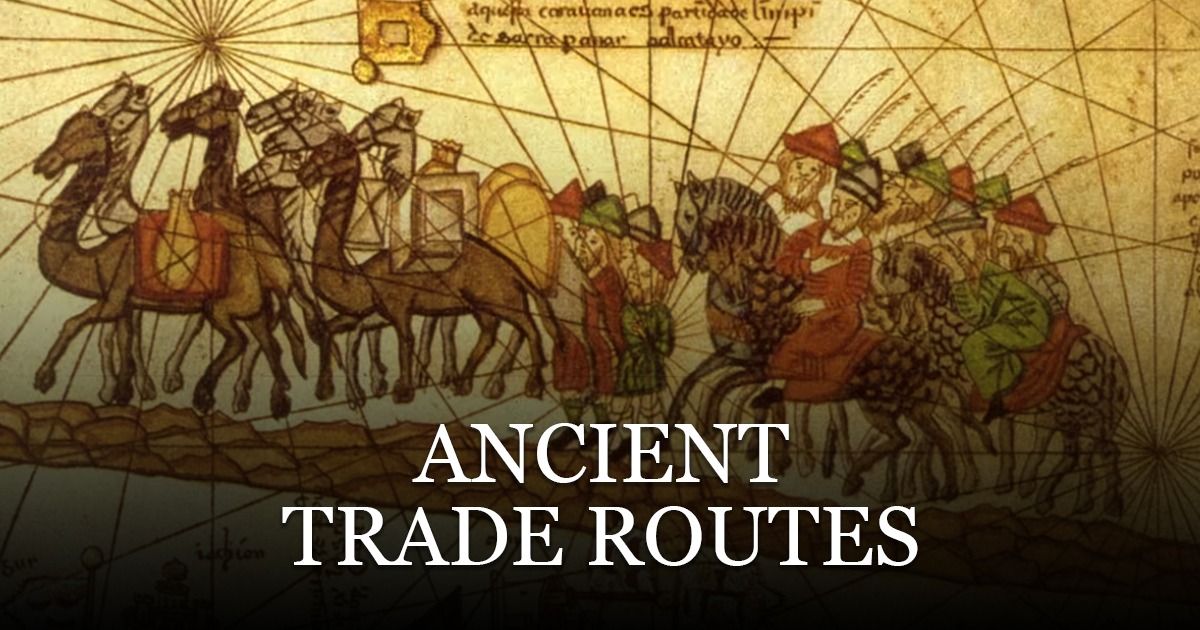
Before borders were lines on a map, the ancient world held together through roads, sea lanes, river corridors, and caravan paths. These routes moved more than cargo. They transmitted skills, scripts, beliefs, and bargaining habits. Grain and glass travelled, but so did weights and measures; gods took new names; recipes and remedies crossed languages. This pillar post sets out the working parts of those networks and shows how they shaped daily life from Iberia to the Indus and beyond.
Why routes mattered
Trade in antiquity was not a side hustle; it was a survival strategy. Tin met copper to make bronze. Timber reached treeless plains. Salt preserved fish far from the sea. Rulers who could secure the pass, dredge the harbour, patrol the road, and post fair measures tended to hold loyalty. In return, traders brought taxes, news, specialists, and sometimes the very officials who kept order. Networks made distance negotiable; they also made strangers legible to one another.
Caravans, convoys, and relay points
Overland routes worked as chains of short stages. A caravan rarely carried goods from one end of Asia to the other. Instead, merchants moved consignments between market towns, selling on to partners who knew the next stretch. Waystations offered water, fodder, scribes, and safe storage. Receipts and sealings travelled with cargoes so that trust could ride along with the bales. Relay logic kept risk modest and pace steady.
Ship lanes and wind calendars
At sea, season and wind set the tempo. Along the Indian Ocean, monsoon cycles turned harbours into clocks; captains learned regular outbound and return windows. In the Mediterranean, coastal sailors hugged sightlines while deep-water legs connected major capes. Pilot books listed landmarks, shoals, and anchorages. With practice, harbours became punctuation marks in texts of water and weather that crews could read by habit.
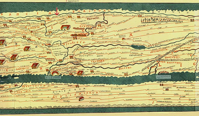
How we know
Archaeology maps these networks with stubborn detail. Cargoes and hulls rest where storms laid them down. Amphorae, stamped and distinctive, reveal what moved and how far. Inscriptions name donors to harbours, bridges, and lighthouses. Hoards of foreign coins fix where routes converged. Written guides and travellers’ notes fill in voice and routine. The picture that emerges is not a single road with heroic carriers; it is a web of local expertise joined by shared tools and rules.
Bronze Age sea cargo: a case from the seabed
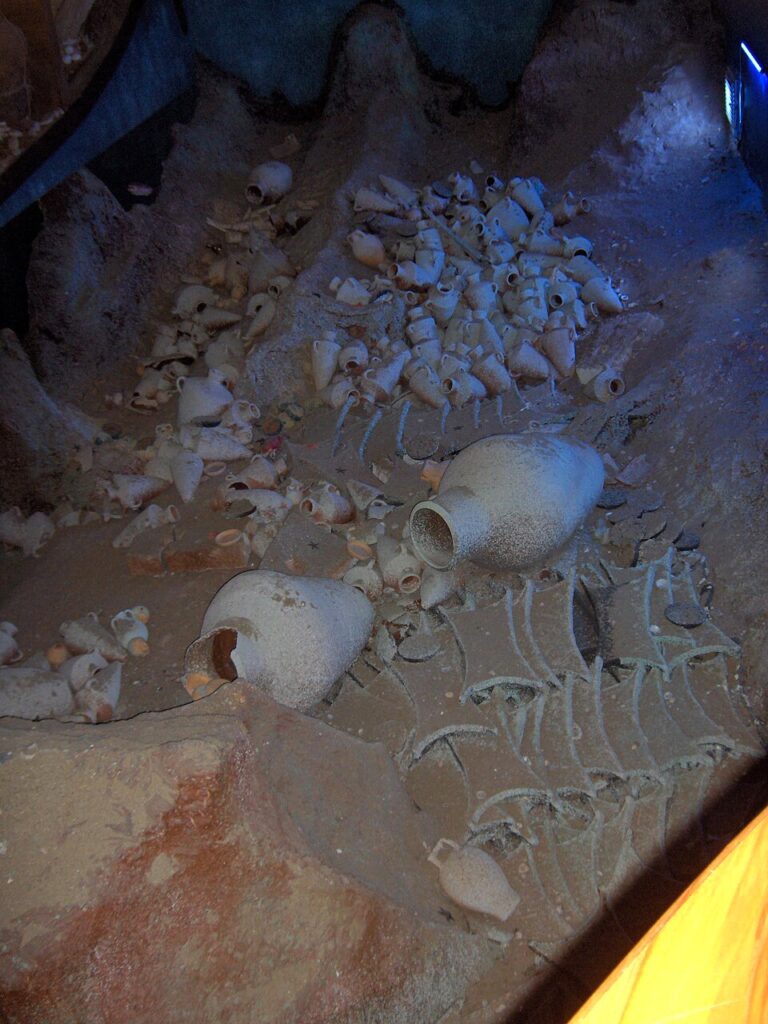
Late Bronze Age cargoes reveal a taste for mixture. Oxhide copper ingots sit beside tin, glass raw materials, resins, and fine tableware. One hold could represent a dozen workshops and half as many languages. Such variety only makes sense in a world of planned relays, prearranged purchases, and trusted brokers in distant ports. A captain did not gamble; he executed contracts others had already formed inland.
Roads as public promises
A good road is more than packed earth. It is an agreement: if you set out today, you can reach the next town by dusk. Stone paving in wet stretches, culverts for run-off, mile markers, and posted tolls all made that promise visible. Roads stitched garrisons to markets and courts to farms. Officials could move; so could news and petitions. With roads came timetables, and with timetables came wider ideas of community.
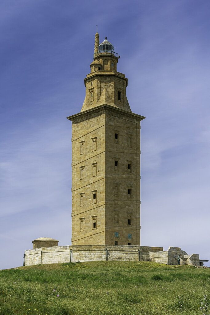
Ports, pilots, and lighthouses
Safe entry to harbour turned trade from gamble to habit. Breakwaters, moles, and dredged channels took brute labour; pilots brought local memory. At night or in fog, fires and towers extended that memory along the coast. Sea lanes became corridors of expected light, where a captain could find a harbour’s mouth by angle and blink rate. Maritime infrastructure is rarely glamorous in ruins, yet it holds the story of how cities grew rich enough to fund their statues.
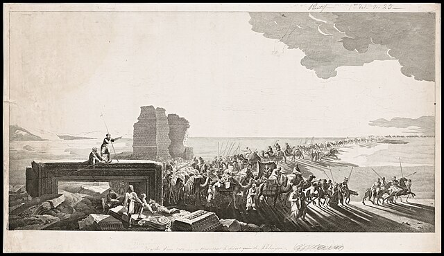
Caravan cities and desert intelligence
Oases became logistics hubs, not romantic outposts. Wells were measured, guarded, and rationed; fodder had a price; scribes recorded debts; sanctuaries hosted treaties. Camel strings stretched capacity beyond donkeys and oxen, but they also required grazing schedules and veterinary skill. Desert routes taught timing as strictly as monsoon sailing did. Patrols and tolls kept order and paid for maintenance. Caravan cities were not lucky accidents. They were built plans.
Weights, measures, and fairness
Without standards, trade collapses into argument. Sets of weights in stone, bronze, or baked clay appear wherever exchange mattered. Posted measures in markets made short-changing risky. Seals on jars fixed responsibility during transit; broken impressions told officials where loss occurred. Over time, communities learned to treat precision as public virtue. It is no accident that many early laws obsess over scales, storage, and fees. Fairness was infrastructure.
Paperwork on the move
Writing travels with goods. Bills of lading, tally sticks, and receipt tablets join cargoes to their owners and agents. Contracts specify quality, quantity, and timing. Lists make promises visible. When traders from different languages meet, double-entry forms and bilingual labels reduce quarrels. Archives in ports and caravanserais record disputes and settlements so that next season’s deals feel safer. Bureaucracy is the quiet engine that turns one-off trips into routine routes.
Ships, rigs, and hull logic
Vessels are compromises between cargo volume, speed, draft, and handling. Broad-beamed carriers suit bulk crops and amphorae; leaner hulls suit speed and distance. Square sails lift heavy loads with simple rigging; mixed rigs permit finer control of angle and tack. In some waters, sewn-plank hulls thrived because they flexed with waves and saved metal fastenings. In others, mortise-and-tenon joinery held tight under hard driving. Ship types spread along with pilots who could teach new crews how to use them.
Tools for time and sky
Navigation improves with instruments and predictable calendars. Simple shadow sticks, star lists, and noon-sight rules help pilots fix course. On coasts cluttered with capes and islands, a reliable way to anticipate sky and season saves lives and cargo. Technical devices for tracking cycles did not live in libraries alone; they sat on tables in workshops and pilot houses, where craft knowledge and calculation met.
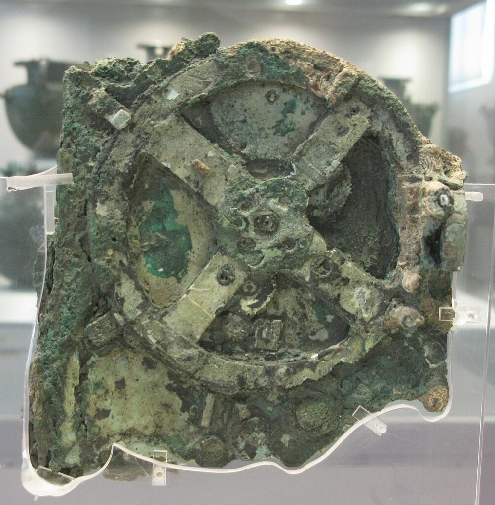
Description: Hellenistic gearwork used to model celestial cycles—a reminder that precise timekeeping supported movement and planning. Source: Wikimedia Commons
Ports as classrooms
Harbours teach skills through mixture. A dockside brings shipwrights, rope-makers, pilots, customs officers, translators, carpenters, and priests within earshot. Together they make a city that can learn. Techniques jump trades; recipes jump kitchens; melodies and measures jump into new ears. The port is where standardisation meets improvisation. When we map routes, we should mark not only the lines between places but the places that pulled strangers into useful conversation.
What moved, and why it mattered
Metals and stone form the hard spine of exchange, but soft goods matter just as much. Textiles carry status and climate control; dyes and aromatics carry ritual and taste; papyrus and parchment carry memory. Foodstuffs—olive oil, wine, garum, dates, grain—move seasonal surpluses to hungry markets. Animals travel too: horses for war, camels for haulage, mules for mountains. Every object teaches a lesson about where skill lives and how communities hedge risk.
Taxes, tolls, and incentives
States rarely funded routes out of pure benevolence. Tolls at bridges, passes, and harbours paid for repairs and garrisons. Customs fees at city gates supported courts and storage. Yet many rulers knew to keep rates tolerable. Kill the route with greed and you lose more than revenue; you lose the loyalty of communities that depend on fair movement. Successful regimes treated maintenance and moderation as a pair.
Security without paralysis
Banditry and piracy were real, but overreaction could choke exchange faster than thieves. Convoys, patrol schedules, beacon chains, and negotiated safe-conducts created zones of predictable risk. Insurance by partnership spread losses across investors. Merchants accepted some danger as the price of speed. The aim was not perfect safety; it was survivable odds.
Rituals of trust
Markets ran on gestures as much as on coin. Shared meals, oaths before images, and gifts between hosts and visitors built reputations. Temples near harbours and gates doubled as arbitration spaces. Festivals drew traders into schedules that courts could anticipate. When we see statues and altars in port districts, we should read them as tools for credit as well as devotion.
Route cities in profile
Palmyra
At the brink of the Syrian steppe, Palmyra managed desert intelligence: water rights, animal breeding, escort arrangements, and tribute. Merchants kept branch houses in far-flung towns, knitting oases into a chain. Funerary portraits show families that spoke multiple languages and wore blended fashions—a visual ledger of exchange.
Byzantion and the straits
On the Bosporus, tolls and pilotage turned narrow water into steady income. Control of the channel stitched Black Sea grain and fish to Aegean markets. Forts and fires kept lanes honest; tax farmers kept accounts honest enough. A city on a chokepoint becomes a broker of regions, not merely a gatekeeper.
Muziris and the monsoon
On India’s Malabar Coast, ports thrived on two-way winds. Pepper and fine textiles left; coin and wine arrived. Warehouse districts bear witness to careful scheduling: one season inward, another outward, with shipyards busy between. Inland traders brought hill products downriver to meet hulls trimmed for ocean swells.
Ideas on the move
Religious teachers walked and sailed with merchants. Shrines and monasteries near waystations offered food, news, and script services. Along routes, belief adopted local dress. A goddess of the sea might take a new name in a strange harbour; a rule for fasting might shift to match a new calendar. Philosophies also travelled in the mouths of tutors and the margins of books. Law codes borrowed procedures from neighbours when those procedures worked.
Language, scripts, and translation
Traders created stable mixtures of speech: pidgins in ports, scribal conventions in warehouses, formularies for contracts. Alphabets simplified where needed, syllabaries held where sound systems demanded them. Bilingual inscriptions on milestones and customs houses show how officials made themselves legible to passersby. Literacy for trade was often practical rather than literary—enough to read a receipt, count a bale, and note a date.
When routes faltered
Drought, silted harbours, war, or neglected roads could move commerce elsewhere in a season. A city that forgot to dredge watched grain ships stop calling. A pass without patrols diverted caravans to friendlier slopes. Yet routes rarely died outright; they shifted, split, or crept back when conditions improved. The map of movement is elastic, not brittle.
Reading the evidence well
Good history resists tidy tales of single roads and heroic couriers. It looks for repair layers in pavements and patch timbers in hulls. It weighs inscriptions against the places they stood: a toll list near a bridge; a lighthouse dedication on a headland; a customs stele by a wharf. It considers the quiet objects—weights, seals, tally sticks—before it quotes a poem. Above all, it treats fairness, maintenance, and timing as the three pillars of ancient movement.
What lasts
The strongest legacy of ancient networks is not a set of princess cargos or miracle capes. It is a way of making distance manageable. Shared calendars for wind and flood. Shared standards for weight and measure. Shared habits of posting rules where strangers can see them. When those habits return, trade returns. In that sense, the old routes have not gone anywhere. They sit beneath modern maps, waiting for the same ordinary virtues to bring them back to life.