From Myth to History: How Scholars Separate Legend from Reality — 2025 Evidence-Based Guide

From Myth to History is not a demolition job on old stories. It is a disciplined way to read them: identify what kind of text or image you are looking at, place it in time and social use, and then test its claims against other evidence. When scholars say they have moved from myth to history, they mean they have turned narratives that carry ritual, identity, or memory into questions that can be checked—by texts, objects, landscapes, and science. The result is not cynicism. It is clarity. This guide explains the method as working historians use it: source criticism, genre awareness, archaeological context, epigraphy and papyrology, scientific dating, and cross-comparison. It also shows why legend remains valuable: myths preserve priorities, fears, and hopes that archives alone cannot store. The craft lies in refusing to flatten either side. We take myth seriously as myth; we extract history where the evidence is strong; we mark the edges where the trail runs thin.

Why “myth” is not the enemy of “history”

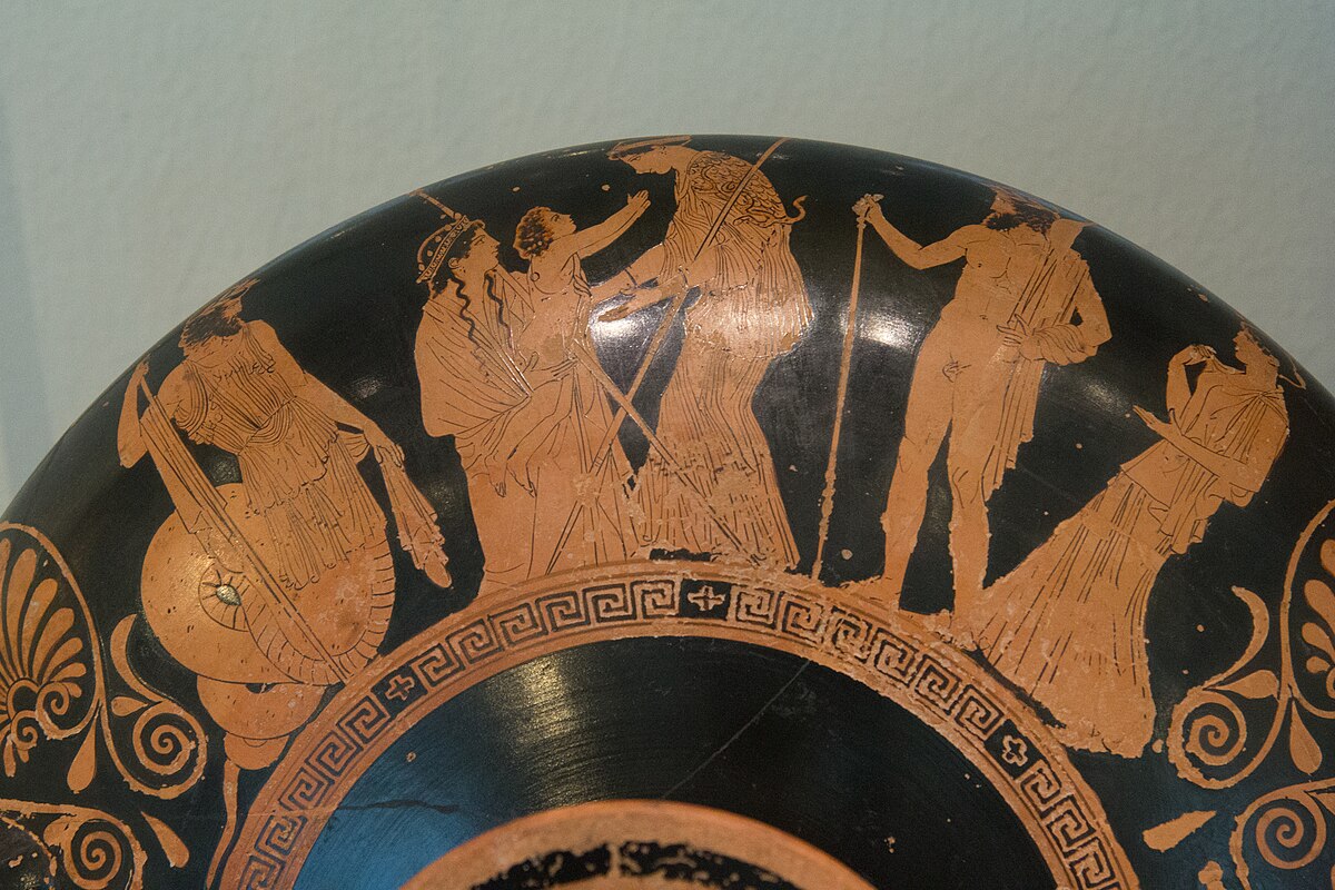
In ancient worlds, myth is a language for truth claims that do not fit minutes or receipts. Founders, floods, city gods, golden ages—their details vary, but their work is similar: to explain why a people belongs in a landscape and what behaviour counts as loyal. From Myth to History does not ask myth to be a modern report. Instead, it asks: what kinds of truth does this myth claim, and which parts touch events or institutions we can test? For a wider map of traditions, see Comparative Mythology: Greek, Roman, Norse, Egyptian. Separating legend from reality begins by sorting functions. A funerary hymn is not a boundary stone. A king list is not a lament. Each form carries its own rules of evidence and its own relationship to the past. Once we respect those rules, we can start to look for anchors: names, regnal years, place-names, treaties, tax lists, coin hoards, ruined walls.

How evidence is built: the historian’s toolkit

Good history is cumulative. No single object proves a grand claim. Instead, we look for convergences, where independent lines of evidence point in the same direction.

1) Source criticism and genre

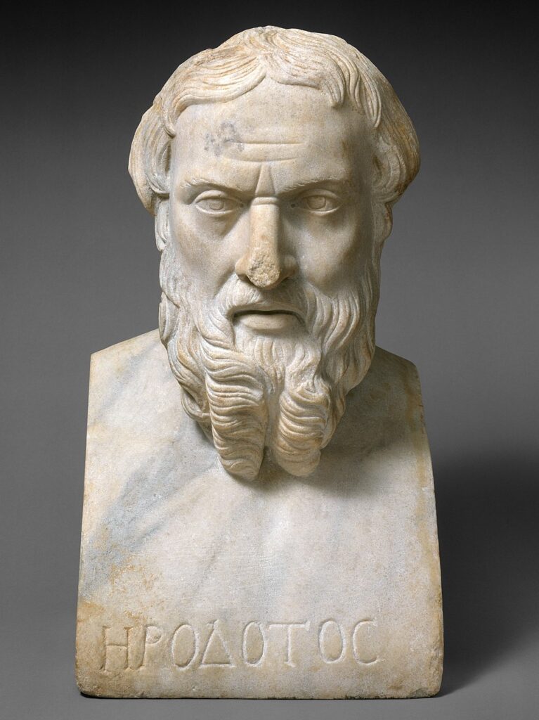
Who produced the text or image, for whom, and why? Is it epic poetry, a dedication, a law code, a temple relief, a votive graffito, a letter, a king list? We read with the right expectations. Herodotus mixes travel report, oral tale, and moral reflection. Egyptian battle scenes record victory as cosmic duty. Hittite treaties preserve clauses and witnesses. Each genre asks different questions and tolerates different kinds of exaggeration. For story structure in epics, see The Hero’s Journey in Ancient Myths.

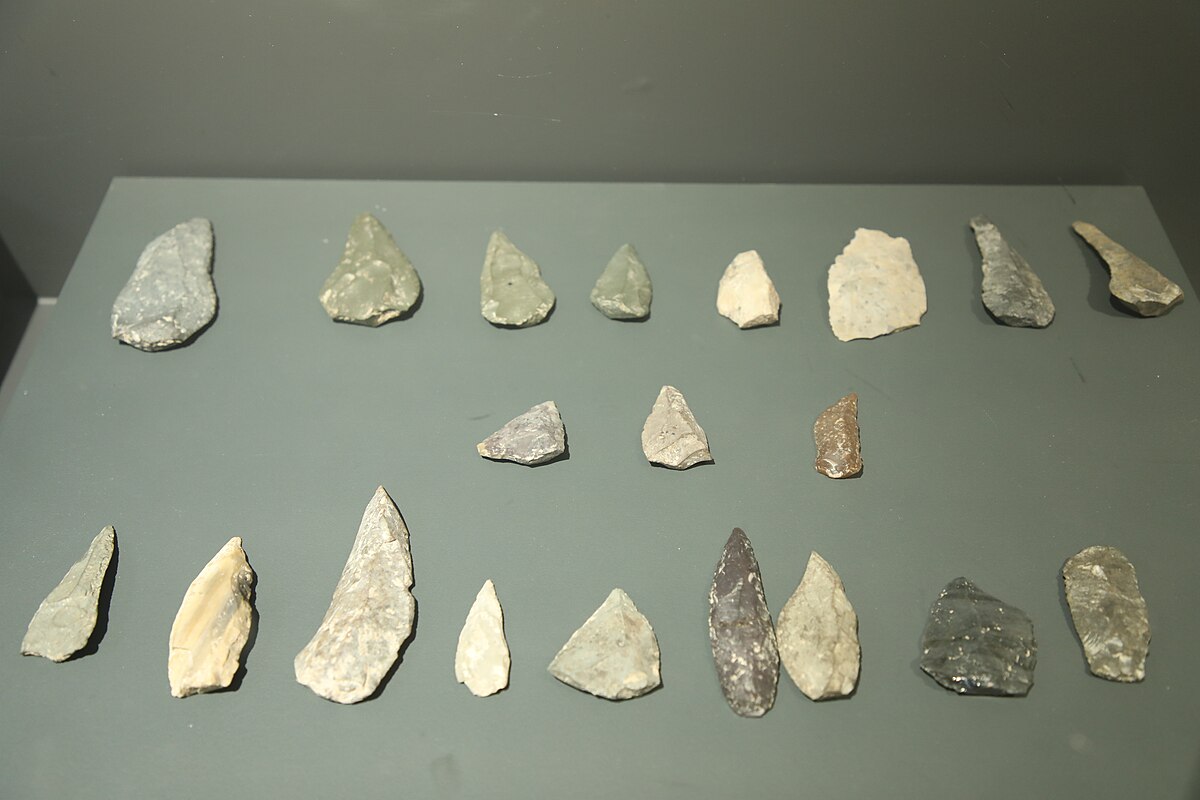
2) Archaeology and context

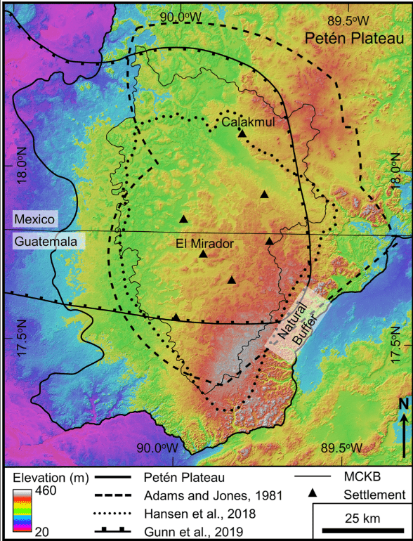
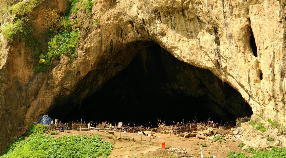
Objects are persuasive only when we know where they were found, in what layer, and with which neighbours. A spearhead without a context is a curiosity; a spearhead inside a sealed destruction layer next to sling bullets and fire debris is a battle. Excavation phases, stratigraphy, ceramic sequences, and radiocarbon anchors turn objects into timelines. Context moves us from myth to history because it links story to soil. For biomolecular casework tied to ritual sites, compare Göbekli Tepe 2025: Biomolecular Clues.

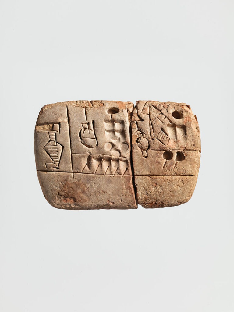
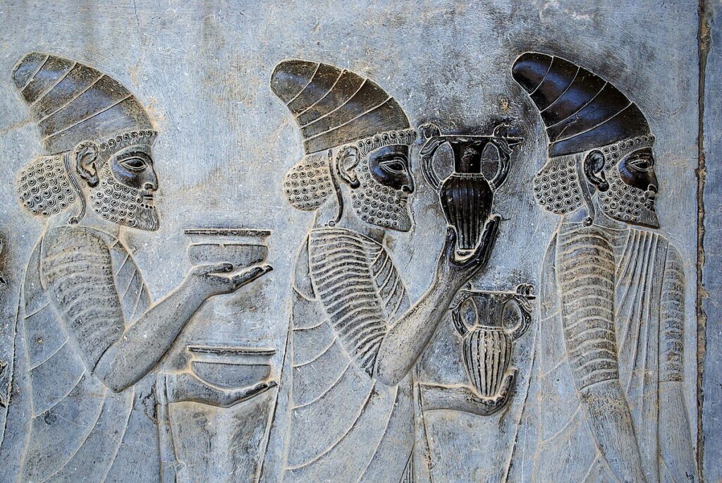
3) Epigraphy, papyrology, and numismatics

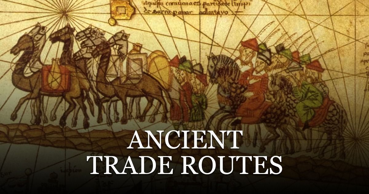
Inscriptions write institutions into stone: decrees, boundaries, taxes, titles, names. Papyri catch everyday life: receipts, petitions, leases, letters. Coins speak about authority, economy, and self-presentation—who mints, what image claims legitimacy, where coins travel, how they are clipped or countermarked. This documentary layer tests or corrects literary memory. For movement across regions, see Ancient Trade Routes.

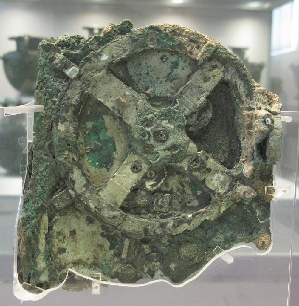
4) Scientific methods

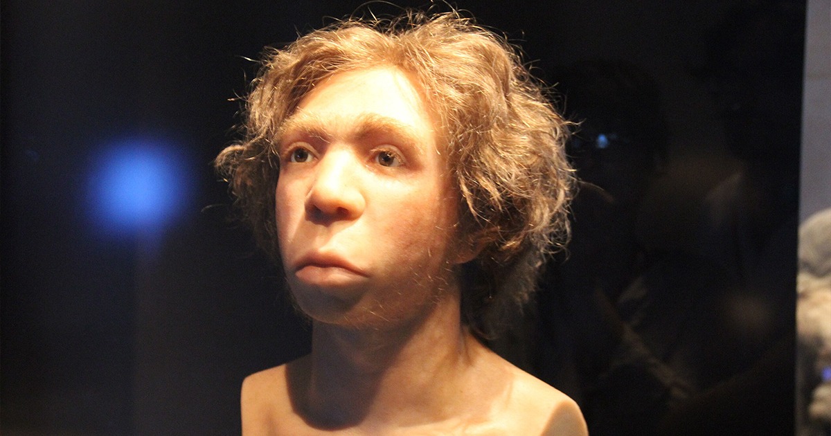
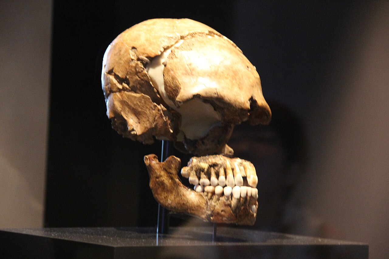
Radiocarbon dating framed by Bayesian models situates organic remains; dendrochronology adds year-level precision where wood survives; stable isotopes track diet and mobility; aDNA reveals kinship and population movement. Science does not replace history. It refines the dates and tests narratives for plausibility. When told carefully, it does not outrun its resolution or pretend to answer questions it cannot see. For examples, compare aDNA and diet work in Neanderthal Medicine Rediscovered.

5) Linguistics and place-names

Languages leave tracks: loanwords, sound shifts, and names that stick to rivers and hills. A heroic tale set at a site with an ancient non-Greek toponym suggests deep continuity beneath later story paint. Linguistic work rarely “proves” a legend, but it narrows the field of what could have happened and when. For decipherment breakthroughs and limits, see AI Deciphering Linear A (2025) and a cautionary counterpoint in Rongorongo: Why Decipherment Keeps Failing.

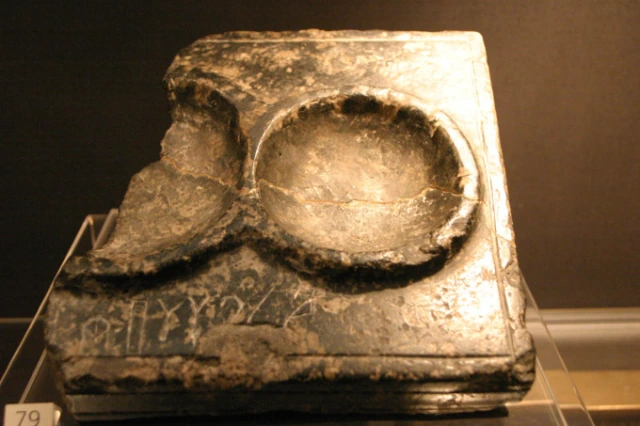
Case studies: where legend meets the record

Troy and the long argument

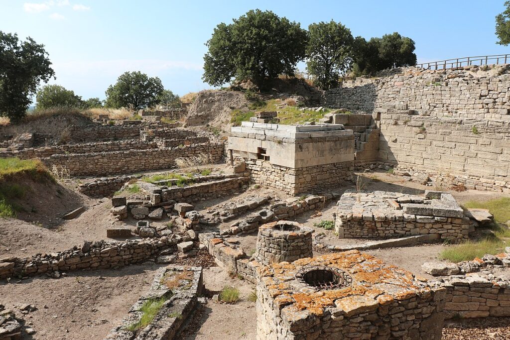
For centuries, Troy lived as poetry. Excavations at Hisarlik, however, revealed a complex citadel with multiple destruction layers. The site does not “prove Homer,” and Homer does not inventory the site. Yet when fortifications, fire levels, regional upheavals, and Hittite texts mentioning a place likely to be Wilusa align, historians move from myth to history responsibly: there was a powerful city; it suffered violent episodes; late Bronze Age politics in the region were real. The story’s poetic core survives, but its edges sharpen. As a related line of evidence about post-war diaspora, see our note on a Trojan-linked community in The Lost City of Tenea.

From Myth to History at Troy: excavations at Hisarlik revealing fortifications and layers.
Exposure of citadel walls and layers used to test Homeric traditions against context. Source: Wikimedia Commons (CC BY 2.0).

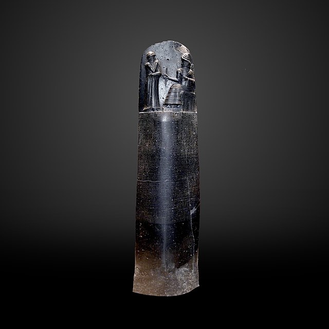
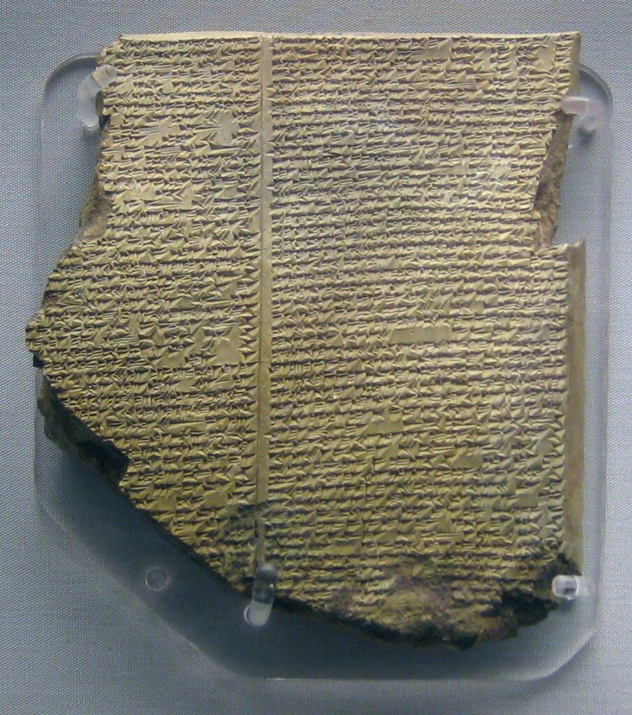
Gilgamesh: a king behind the epic

The historical kernel of Gilgamesh likely sits in an early dynastic ruler of Uruk. The epic, compiled over centuries, wraps him in cosmic quests and flood wisdom. Clay tablets, king lists, and archaeological layers at Uruk confirm the city’s scale and ambition; they do not ask us to believe in immortal plants. Still, the epic’s grief and city pride record social truths we can map: urban labour, friendship under risk, and the limits of royal power. For Mesopotamian mythic figures that shaped later memory, compare the Apkallu traditions.

From Myth to History via cuneiform: the Flood Tablet from the Epic of Gilgamesh.
Neo-Assyrian tablet preserving the flood narrative; cross-checked with king lists, archaeology, and city layers. Source: Wikimedia Commons (CC0).

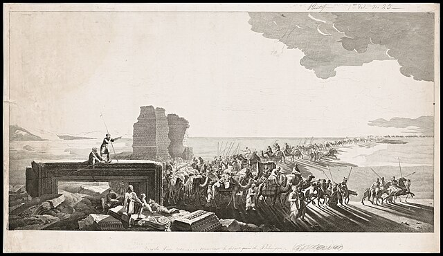
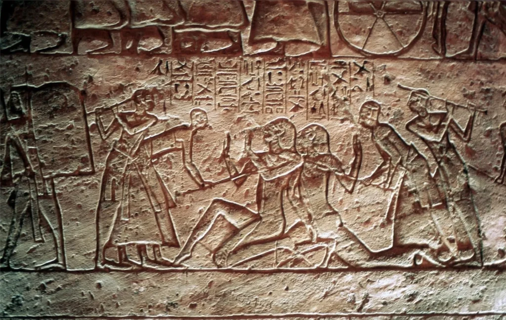
Ramesses II at Kadesh: victory, propaganda, and a treaty

Egyptian reliefs proclaim triumph; the Hittite treaty and duplicate Egyptian copies show a negotiated stalemate. Reading both sides, alongside topography and chariot archaeology, moves us away from simple boasts toward the political reality of parity. Here mythic self-presentation—king as guarantor of cosmic order—sits on top of a documentable diplomatic outcome. For the mechanics of state image-making, see Julius Caesar’s PR Machine.

From Myth to History at Kadesh: Ramesses II smites foes at Abu Simbel while a treaty tells another story.
Monumental reliefs claiming victory set against the surviving Egyptian–Hittite peace treaty. Source: Wikimedia Commons (CC BY-SA 3.0).

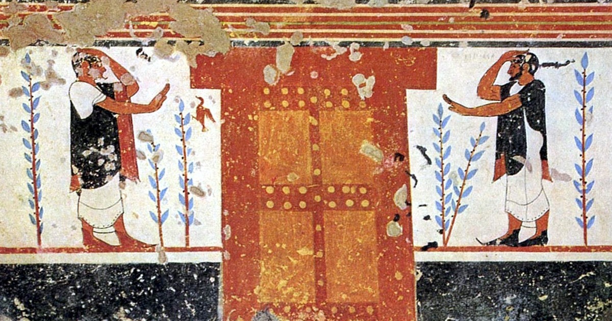
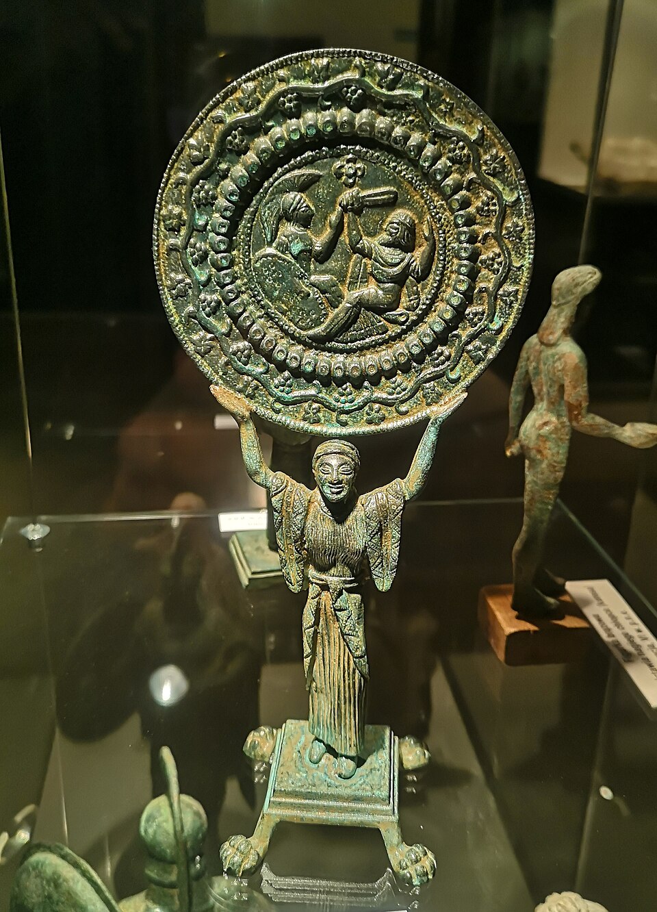
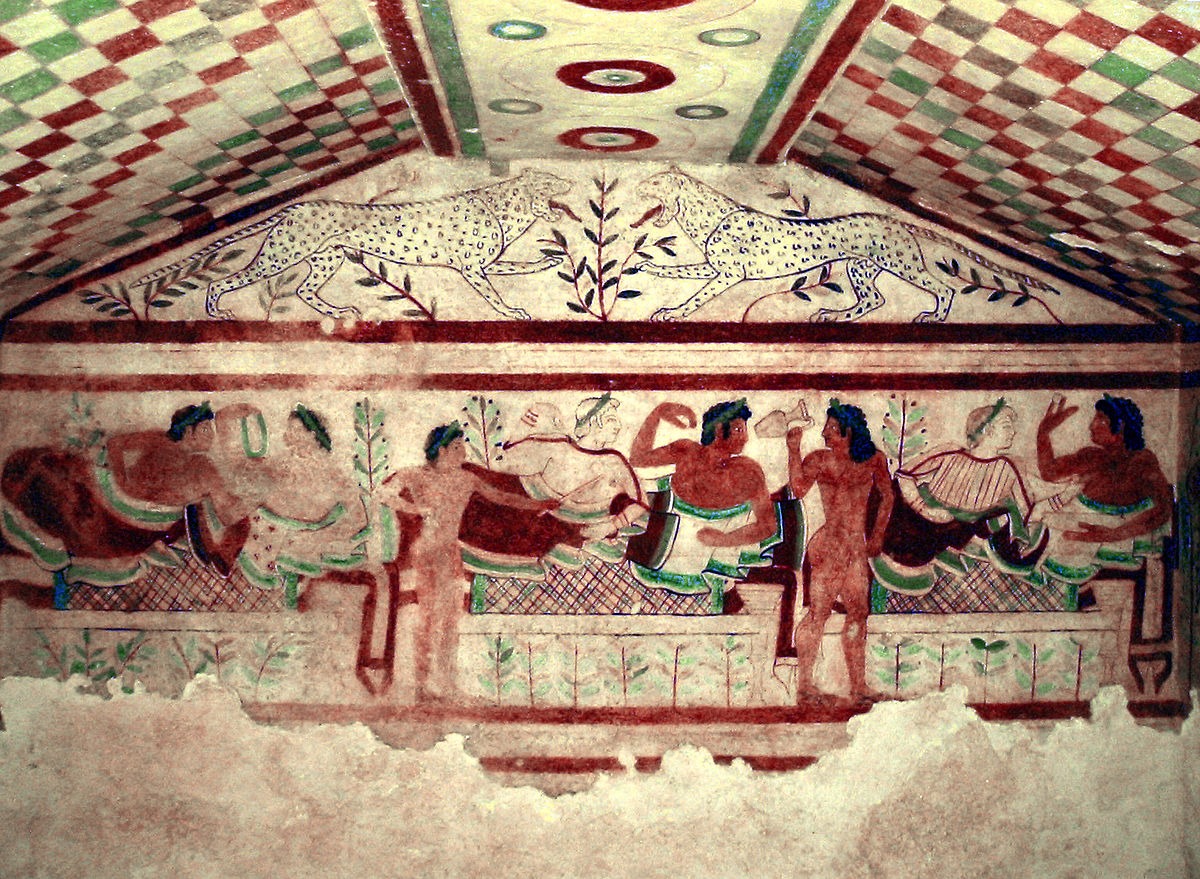
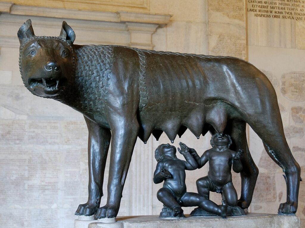
Rome’s foundations: wolves, hills, and the Palatine

Romulus and Remus are narrative glue. Archaeology on the Palatine shows hut foundations and early walls consistent with a nucleated community in the period later Romans imagined. Ritual calendars, foundation myths, and political memory in Livy do not become “false” because huts are small; nor do huts “prove” a she-wolf. The method respects both: myth articulates values for rule and kin; archaeology marks when a hill turns into a city. For the long arc of state-building that followed, see How Rome Built an Empire That Lasted 1000 Years.

From Myth to History at Rome: the Capitoline Wolf and debates about origins.
Emblematic sculpture tied to Rome’s foundation story; compared with Palatine stratigraphy and early urbanisation. Source: Wikimedia Commons (Public Domain).

Decipherment and the power of parallel texts

Sometimes legend yields to history when scripts fall open. The trilingual Behistun Inscription let scholars read Old Persian and, later, Akkadian cuneiform reliably. Once records became legible—campaigns, building lists, tribute—it was possible to test royal claims, date events, and compare neighbours’ testimonies. Decipherment does not make texts neutral, but it gives them back their voice. For successes, see Linear A AI attempts in 2025; for limits, see Rongorongo’s stalled decipherment.

From Myth to History through decipherment: the Behistun Inscription relief of Darius I.
Trilingual inscription that enabled major decipherments and anchored Achaemenid history. Source: Wikimedia Commons (CC BY-SA 3.0).

Method, step by step (without turning it into a checklist)

We do not need “ten ways.” We need a sequence we can defend. Start with form and setting. Name the genre, date, and probable audience. Ask what the text or image is trying to do in its first life. A hymn pleases a god and a crowd; a treaty binds two kings; a boundary stone frightens trespassers. These purposes shape what can be trusted and how. Stabilise the chronology. Use radiocarbon ranges and ceramic phases to frame layers; add inscriptions and coin series for tighter anchors; let dendrochronology or eclipse records refine the line where possible. Chronicle first; argument second. Find independent points of contact. A place-name in a poem, a river crossing in a relief, a tax rate in a papyrus—none is decisive alone. Together, they form a lattice. When a story lands multiple times on that lattice, confidence grows without claiming certainty. Resist the neat fit. Some parts will never meet the checkable world. That is fine. Ritual animals, divine visitations, marvels—these tell us about values and metaphors. To force them into a file of proofs is to ruin both myth and method.

Common errors that keep legend and reality tangled

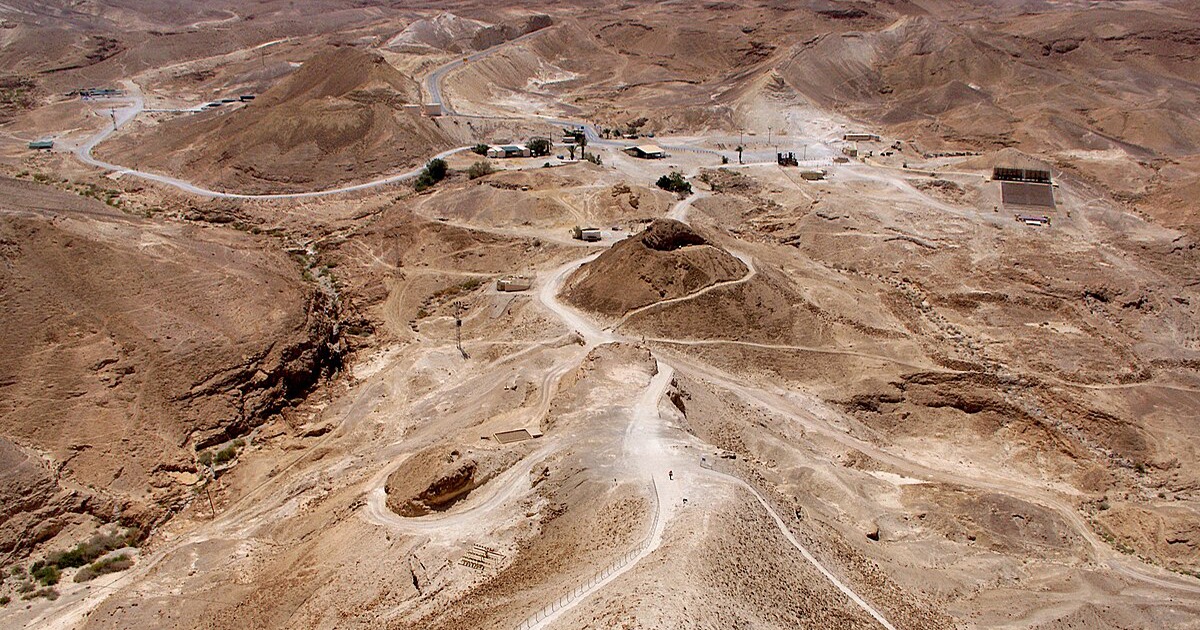
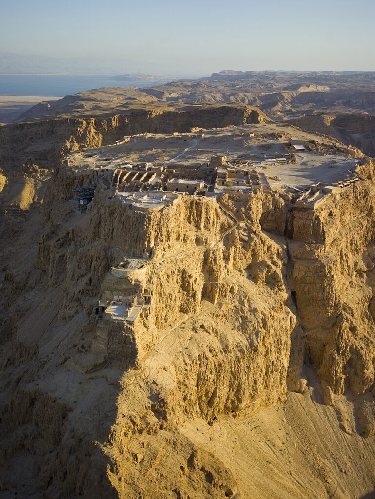
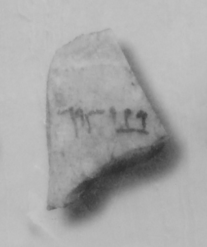
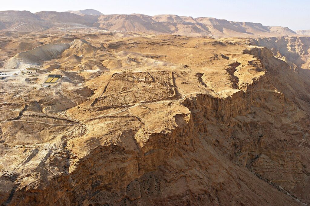
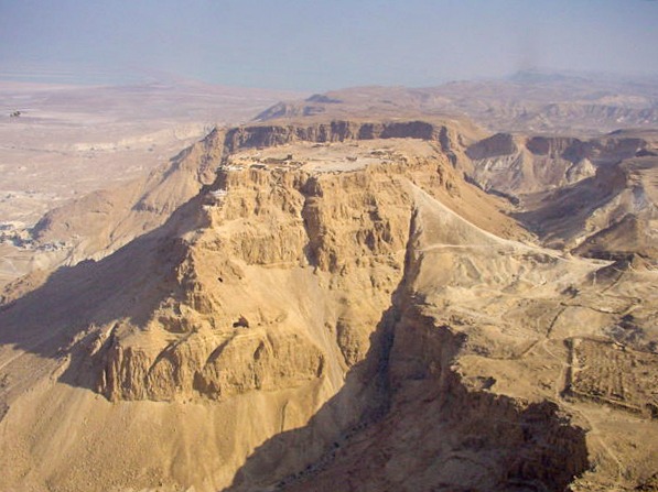
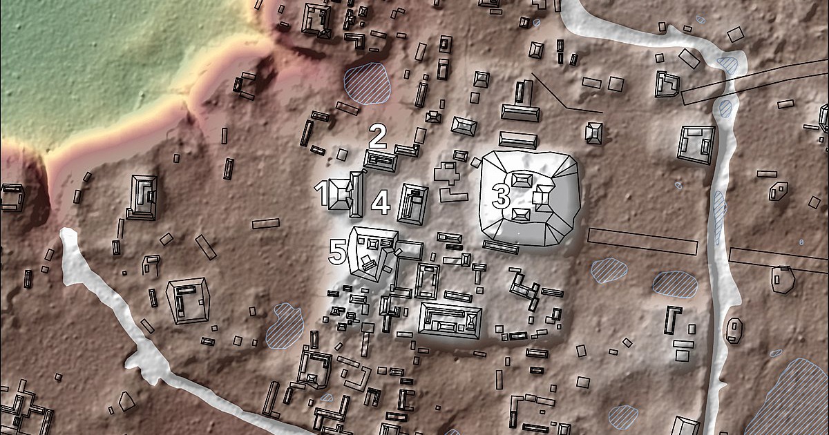
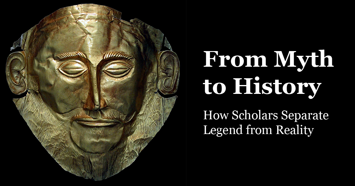
Presentism. Reading ancient stories as if they were op-eds on today’s politics is quick and tempting. It also erases their own problems and solutions. Responsible comparison isolates the ancient question first and then, carefully, uses it to think about now. Argument from silence. Absence of evidence is not evidence of absence. Archaeology is uneven; papyri rot; inscriptions break; chance saves the oddest things. Silence can constrain claims, but it cannot settle them without positive indicators. Single-source triumphalism. An object with a headline should not run the whole argument. The “Mask of Agamemnon” remains beautiful whether or not it touches Homer’s king. We win from myth to history when multiple sources carry modest claims together. For a worked example of checking a dominant narrative, see Masada vs Josephus: Archaeology vs Text. False precision. Bayesian models are not magic; radiocarbon dates are ranges; genetic signals are population stories, not passports with names. Use numbers to narrow; never to pretend certainty where the material cannot support it.

What science adds—and what it does not

Radiocarbon and dendrochronology frame events; isotopes test migration and diet; aDNA shows kinship and large-scale movement. These methods shift debates: migration versus diffusion, continuity versus replacement, famine versus trade reorientation. Still, science answers the questions its samples can see. It does not declare whether a god “exists” in a story, nor whether a miracle happened. It can, however, date a layer, identify a parasite, trace a herd, match a corpse to kin in a tomb. That is already transformative. For climate-tech from antiquity, compare Roman concrete’s modern relevance.

Why legend remains valuable after the audit

Even after we cut a story free from the duty to inform us about events, it continues to tell truths. Founders raised by wolves say something about how Romans imagined toughness, nurture, and law on a knife-edge. Battle reliefs that always win say something about the cosmic burden kings claimed. Floods that cleanse and restart say something about fear, hope, and justice. For symbols and beings across cultures, browse Mythical Creatures A–Z. From Myth to History is not a downgrade. It is a double reading, where metaphor and measurement face each other without embarrassment.

Teaching and writing with integrity

When we teach or write, we can model the craft: Say what you know and how you know it. “Excavation phase IV, dated 1250–1180 BCE by radiocarbon and ceramics, contains sling bullets and fire damage; Hittite texts refer to Wilusa in roughly the same period.” That is better than “Homer was right,” yet it lets a reader feel substance. Admit limits. “No inscription names Romulus in the 8th century BCE; the story’s earliest versions we have are later; but huts and fortifications on the Palatine align with a shift from villages to a city.” Limits are not weakness; they are the edge of the map. Split the claim. Separate what you infer about events from what you read about meaning. “The treaty existed; the relief claims a cosmic victory.” Both can be true in their registers. For a structured overview of the field, see Ancient History: A Practical Guide.

Frequently asked questions

Does moving from myth to history “disprove” ancient religion?

No. The method answers questions about events, institutions, and timelines. It does not adjudicate metaphysics. It can show when a cult starts, how it spreads, and how its rituals shape cities. That is history’s job.

Can archaeology ever “prove” a literary episode?

Rarely, and only in strict senses: a named place, a building phase, a destruction layer, a treaty text. What we usually gain is plausibility, sequence, and scale. That is a win.

How should conflicting sources be handled?

Do not average them. Read each in its own purpose and audience; then test their checkable parts against independent anchors. Let the remainder stand as perspective, not data.

Further looking and reliable object pages

To practice the method, pair texts with open collections that provide context fields, measurements, and provenance notes. Explore the British Museum collection and The Met’s Open Access collection; both maintain detailed records that help you move responsibly from myth to history.

Presentism in Ancient History (2025): How Modern Bias Distorts the Past

Presentism in Ancient History is the habit of reading ancient evidence through contemporary assumptions, values, and language. It is easy to commit and hard to detect. This guide clarifies what presentism is, why it skews arguments, and how to build methods that respect context while still asking modern questions responsibly.

Ancient history is not a mirror; it is a different country with unfamiliar institutions, words, and mental worlds. We can learn from it only if we notice where our own categories warp what we see. Below you will find a clear definition, core mechanisms of distortion, case studies, a step-by-step method to reduce bias, and practical tips for citations, translation, and images.

Defining presentism (without retreating into relativism)

Presentism is not the same as relevance. We can ask present-day questions about power, economy, gender, law, or race. The mistake lies in importing modern definitions wholesale and then grading ancient cultures against them. When we impose today’s morality tests, legal standards, or social categories onto the ancient record, we misread both what the sources meant and what audiences heard.

Two quick rules keep the boundary clear. First, interpret sources according to ancient contexts; second, apply insights responsibly to modern debates after that work is done. In other words, read as a historian before you read as a citizen.

Where presentism sneaks in: seven common mechanisms

1) Translation drift

Loaded words in English (freedom, democracy, religion, race) rarely map cleanly onto Greek, Latin, Egyptian, or Akkadian terms. Translating dēmokratia as “democracy” invites readers to imagine universal suffrage, secret ballots, and liberal rights. None of that applies to classical Athens. The fix: annotate key terms and, when possible, quote or transliterate the original word with a brief gloss.

2) Moral anachronism

Judging ancient actors by modern ethical frameworks can yield satisfying verdicts but poor history. We should not excuse harm, yet we must place choices within ancient horizons of possibility: laws, customs, available arguments, and costs. Good writing separates two sentences: “By modern standards this was unjust” and “Within their world this action signalled X.”

3) Category confusion

Modern binaries (public/private, sacred/secular, state/market) often blur in antiquity. City, cult, family, and economy braided together. If you keep forcing clean modern boxes, evidence will look inconsistent when it is actually integrated by design.

4) Teleology

Reading outcomes backward (“Rome was bound to conquer,” “Athenian democracy evolved inevitably toward us”) makes contingency disappear. Teleology turns history into a conveyor belt and hides roads not taken. Replace inevitability with pathways, forks, and lost alternatives.

5) Source selection bias

Our archive is skewed: elite authors, court art, durable materials, lucky survivals. If we keep citing the same narrow genre (e.g., historiography) without epigraphy, papyri, archaeology, or comparative material, we amplify the bias already in the record.

6) Museum mediation

Labels, lighting, and famous objects can overdetermine meaning. A single inscription under bright glass can look like the voice of a people. Use museum displays as starting points, then check full object records, find-spots, and parallel exemplars.

7) Present-day politics and headlines

Modern debates (citizenship, empire, repatriation, ethnicity) offer helpful questions but also built-in heat. Frame links explicitly: “We ask this modern question after we reconstruct ancient meanings.” The order matters.

Avoiding presentism in Ancient History: Code of Hammurabi stele showing law framed as kingship, not modern statute.
Diorite stele with prologue, laws, and epilogue; ancient law presented as royal justice and divine mandate. License: per Commons page.

Case studies: how modern bias distorts the past

Interpreting “democracy” at Athens

Calling classical Athens a “democracy” invites readers to imagine modern citizenship. But Athenian dēmokratia excluded women, most migrants, and enslaved people; it used sortition, public pay for jury service, intense face-to-face speech, and ritual closure. Presentism enters when we grade Athens against 21st-century norms rather than reconstructing the distinctive mechanics and aims of the Athenian system.

Reading imperial ideology in Roman sources

Descriptions of “civilising missions” or “bringing peace” sound familiar. If we project recent imperial rhetoric onto Augustan monuments or Tacitean prose, we may miss how Roman audiences linked conquest with cosmic order, ancestral exempla, and patronage networks. The remedy is to read claims alongside provincial epigraphy, military diplomas, and archaeology rather than assuming modern frames of empire.

Gender in myth and law

Presentist readings often flatten women’s roles into modern boxes (victim/hero). Ancient evidence shows authority expressed through ritual, property, priesthoods, or guardianship frameworks we lack. Instead of importing modern categories, track the levers that produced power in each context.

Slavery, race, and language

We should state plainly that forced labour and enslavement in antiquity caused profound harm. The presentist trap is to equate ancient terms and social boundaries directly with modern racial constructs. Ancient languages mark status, origin, and ethnicity differently and inconsistently. Careful philology and onomastics help prevent category mistakes.

The “great man” lens

Modern leadership literature often pulls Alexander, Caesar, or Pericles into a universal “CEO” frame. That frame strips away gods, ritual, civic festivals, land settlements, and law that did as much work as any single person. Replace “leadership secrets” with systems thinking: institutions, incentives, and symbolic capital.

Behistun Inscription relief: multilingual kingship as context against presentism.
Achaemenid relief from the Behistun complex with Old Persian, Elamite, and Akkadian texts; an anchor for cross-checking translations. License: CC0.

How to reduce presentism: a practical method

1) Rebuild context before comparison

For any claim, specify time, place, genre, and audience. Identify the medium (clay, papyrus, stone, bronze, wall painting). Ask who paid for it, who saw it, and how it circulated. Note which groups the evidence omits or marginalises.

2) Annotate key terms and keep a glossary

When a word carries cultural load—dēmokratia, euergetēs, nomos, maat, šarru—define it, cite examples, and prefer transliteration to overconfident equivalents. If you must translate, footnote the compromise.

3) Triangulate genres

Pair narrative sources with epigraphy and archaeology. Set Herodotus or Livy beside decrees, dedications, coin legends, and site reports. Closed loops of literary quotation amplify one elite voice; triangulation tests claims against lived textures.

4) Separate description from evaluation

Write what a practice was and did within its world, then bracket a distinct paragraph for present-day ethical evaluation. Readers can hold both truths when you keep them formally separate.

5) Expose your inference chain

Show how you move from fragment to claim: transcription → translation → parallel texts → material context → inference. If a step is contestable, label it. Presentism thrives in hidden leaps.

6) Use images like evidence, not decoration

Caption objects with date, place, material, and function. Explain what a viewer then would have noticed. Link to object records, not just viral images. Good captions are mini-arguments.

7) Track your own vantage point

Note your disciplinary training, language limits, and modern stakes. Reflexive writing is not indulgence; it is method. When your background increases risk (e.g., strong opinions about modern empire while reading Roman sources), add counter-voices in citations.

Herodotus bust used in discussions of presentism and historiography.
Roman copy of a Greek portrait; opens conversations about ethnography, rhetoric, and the risks of reading him as a modern reporter. License: per Commons page.

Working examples: doing the history first

Law and “rights”

We are tempted to ask whether ancient people had “rights.” That word carries modern legal theory. A safer historical move is to map claims, protections, and procedures available to groups and to watch who could speak in which venue. Then, in a second step, compare those maps with modern rights talk.

Religion and “belief”

Ancient cult emphasised practice over private belief: sacrifices, festivals, processions, oaths. If we import a modern “religion as inner conviction” model, we’ll misread dedicatory inscriptions and overlook how ritual created civic time.

Economy and “markets”

Prices, coinage, and trade existed, but embedded within kinship, patronage, temple estates, and conquest. Projecting modern deregulated markets back onto the ancient Mediterranean hides coercion, redistribution, and ritual economy.

Race, ethnicity, and identity

Ancient texts mark difference via language, custom, dress, homeland, and law. The temptation is to paste modern racial categories on top. Better: show how names and statuses worked locally; then discuss how later readers racialised those categories in reception history.

Thucydides bust highlighting method over presentist storytelling.
Marble bust with neutral background; useful for teaching causation, method, and limits of analogy. License: Public Domain (per Commons page).

How museums and headlines shape readings

Public debates—from the Parthenon sculptures to the display of imperial trophies—create pressure to draft antiquity into modern arguments. Use the pressure as an opportunity to teach method. Put object labels beside source extracts and ask: whose voice; which audience; what message did this send then.

Parthenon frieze in Room 18, British Museum — a live case for presentism debates in display and ownership.
Marble relief panels from the Parthenon; excellent for discussing ancient meanings vs. modern museum ethics. License: per Commons page.

Checklist for writers, teachers, and students

  • Focus keyword anchor: “Presentism in Ancient History” appears in your title, intro, and subheadings—keep it visible as a concept, not a buzzword.
  • Gloss key terms: give the ancient word, a short gloss, and an example.
  • Triangulate: literary source + inscription/papyrus + archaeology.
  • Caption like a scholar: date, place, medium, function, audience.
  • Separate description from evaluation: two paragraphs, two lenses.
  • Expose inference chains: let readers see steps and doubts.
  • Own your standpoint: say what you bring and where you’re blind.

Further reading and object gateways

To anchor arguments in primary material, consult the British Museum Collection Online and The Met Open Access. For law and kingship, pair the Hammurabi stele with cuneiform court records and contracts; for multilingual power, set the Behistun Inscription beside local Elamite and Akkadian versions. When you cite, give inventory numbers or object IDs when available.

FAQ

Does avoiding presentism mean refusing moral judgement?

No. It means reconstructing ancient meanings first, then making moral evaluations explicitly and fairly. You can do both; doing them in order improves both.

Is all comparison presentist?

Comparison becomes presentist when it imposes modern categories before doing historical work. It becomes historical when it lets ancient terms lead and then frames differences carefully.

Can we write for public audiences without presentism?

Yes. Use active verbs, clear structure, and vivid objects. Explain your method in plain language. Readers accept complexity when you show why it matters.

How does this affect classroom practice?

Design assignments that force triangulation (text + inscription + object). Require students to gloss key terms and to mark where they step from description into evaluation. Presentism shrinks when method becomes visible.

Ancient Trade Routes: Networks That Shaped the World

Before borders were lines on a map, the ancient world held together through roads, sea lanes, river corridors, and caravan paths. These routes moved more than cargo. They transmitted skills, scripts, beliefs, and bargaining habits. Grain and glass travelled, but so did weights and measures; gods took new names; recipes and remedies crossed languages. This pillar post sets out the working parts of those networks and shows how they shaped daily life from Iberia to the Indus and beyond.

Why routes mattered

Trade in antiquity was not a side hustle; it was a survival strategy. Tin met copper to make bronze. Timber reached treeless plains. Salt preserved fish far from the sea. Rulers who could secure the pass, dredge the harbour, patrol the road, and post fair measures tended to hold loyalty. In return, traders brought taxes, news, specialists, and sometimes the very officials who kept order. Networks made distance negotiable; they also made strangers legible to one another.

Caravans, convoys, and relay points

Overland routes worked as chains of short stages. A caravan rarely carried goods from one end of Asia to the other. Instead, merchants moved consignments between market towns, selling on to partners who knew the next stretch. Waystations offered water, fodder, scribes, and safe storage. Receipts and sealings travelled with cargoes so that trust could ride along with the bales. Relay logic kept risk modest and pace steady.

Ship lanes and wind calendars

At sea, season and wind set the tempo. Along the Indian Ocean, monsoon cycles turned harbours into clocks; captains learned regular outbound and return windows. In the Mediterranean, coastal sailors hugged sightlines while deep-water legs connected major capes. Pilot books listed landmarks, shoals, and anchorages. With practice, harbours became punctuation marks in texts of water and weather that crews could read by habit.

How we know

Archaeology maps these networks with stubborn detail. Cargoes and hulls rest where storms laid them down. Amphorae, stamped and distinctive, reveal what moved and how far. Inscriptions name donors to harbours, bridges, and lighthouses. Hoards of foreign coins fix where routes converged. Written guides and travellers’ notes fill in voice and routine. The picture that emerges is not a single road with heroic carriers; it is a web of local expertise joined by shared tools and rules.

Bronze Age sea cargo: a case from the seabed

Display of mixed cargo from a Late Bronze Age shipwreck, including copper ingots and storage jars
Mixed goods—ingots, jars, and luxury items—show how Mediterranean sea lanes linked workshops and courts. Source: Wikimedia Commons

Late Bronze Age cargoes reveal a taste for mixture. Oxhide copper ingots sit beside tin, glass raw materials, resins, and fine tableware. One hold could represent a dozen workshops and half as many languages. Such variety only makes sense in a world of planned relays, prearranged purchases, and trusted brokers in distant ports. A captain did not gamble; he executed contracts others had already formed inland.

Roads as public promises

A good road is more than packed earth. It is an agreement: if you set out today, you can reach the next town by dusk. Stone paving in wet stretches, culverts for run-off, mile markers, and posted tolls all made that promise visible. Roads stitched garrisons to markets and courts to farms. Officials could move; so could news and petitions. With roads came timetables, and with timetables came wider ideas of community.

Segment of the Tabula Peutingeriana showing roads, stations, and distances
Schematic copy of a Roman route map with waystations and mileages, used to plan movement across the empire. Source: Wikimedia Commons, public domain.

Ports, pilots, and lighthouses

Safe entry to harbour turned trade from gamble to habit. Breakwaters, moles, and dredged channels took brute labour; pilots brought local memory. At night or in fog, fires and towers extended that memory along the coast. Sea lanes became corridors of expected light, where a captain could find a harbour’s mouth by angle and blink rate. Maritime infrastructure is rarely glamorous in ruins, yet it holds the story of how cities grew rich enough to fund their statues.

Roman lighthouse tower at A Coruña on the Atlantic coast
Ancient lighthouse marking a key Atlantic approach; a sign of public investment in safe navigation. Source: Wikimedia Commons

Caravan cities and desert intelligence

Oases became logistics hubs, not romantic outposts. Wells were measured, guarded, and rationed; fodder had a price; scribes recorded debts; sanctuaries hosted treaties. Camel strings stretched capacity beyond donkeys and oxen, but they also required grazing schedules and veterinary skill. Desert routes taught timing as strictly as monsoon sailing did. Patrols and tolls kept order and paid for maintenance. Caravan cities were not lucky accidents. They were built plans.

Camel train near the ruins of Palmyra against a desert backdrop
Palmyra’s oasis position made it a classic relay between Mesopotamia and the Mediterranean. Source: Wikimedia Commons

Weights, measures, and fairness

Without standards, trade collapses into argument. Sets of weights in stone, bronze, or baked clay appear wherever exchange mattered. Posted measures in markets made short-changing risky. Seals on jars fixed responsibility during transit; broken impressions told officials where loss occurred. Over time, communities learned to treat precision as public virtue. It is no accident that many early laws obsess over scales, storage, and fees. Fairness was infrastructure.

Paperwork on the move

Writing travels with goods. Bills of lading, tally sticks, and receipt tablets join cargoes to their owners and agents. Contracts specify quality, quantity, and timing. Lists make promises visible. When traders from different languages meet, double-entry forms and bilingual labels reduce quarrels. Archives in ports and caravanserais record disputes and settlements so that next season’s deals feel safer. Bureaucracy is the quiet engine that turns one-off trips into routine routes.

Ships, rigs, and hull logic

Vessels are compromises between cargo volume, speed, draft, and handling. Broad-beamed carriers suit bulk crops and amphorae; leaner hulls suit speed and distance. Square sails lift heavy loads with simple rigging; mixed rigs permit finer control of angle and tack. In some waters, sewn-plank hulls thrived because they flexed with waves and saved metal fastenings. In others, mortise-and-tenon joinery held tight under hard driving. Ship types spread along with pilots who could teach new crews how to use them.

Tools for time and sky

Navigation improves with instruments and predictable calendars. Simple shadow sticks, star lists, and noon-sight rules help pilots fix course. On coasts cluttered with capes and islands, a reliable way to anticipate sky and season saves lives and cargo. Technical devices for tracking cycles did not live in libraries alone; they sat on tables in workshops and pilot houses, where craft knowledge and calculation met.

The Antikythera Mechanism
Fragment of the Antikythera mechanism with visible gears and corroded plates
Description: Hellenistic gearwork used to model celestial cycles—a reminder that precise timekeeping supported movement and planning. Source: Wikimedia Commons

Ports as classrooms

Harbours teach skills through mixture. A dockside brings shipwrights, rope-makers, pilots, customs officers, translators, carpenters, and priests within earshot. Together they make a city that can learn. Techniques jump trades; recipes jump kitchens; melodies and measures jump into new ears. The port is where standardisation meets improvisation. When we map routes, we should mark not only the lines between places but the places that pulled strangers into useful conversation.

What moved, and why it mattered

Metals and stone form the hard spine of exchange, but soft goods matter just as much. Textiles carry status and climate control; dyes and aromatics carry ritual and taste; papyrus and parchment carry memory. Foodstuffs—olive oil, wine, garum, dates, grain—move seasonal surpluses to hungry markets. Animals travel too: horses for war, camels for haulage, mules for mountains. Every object teaches a lesson about where skill lives and how communities hedge risk.

Taxes, tolls, and incentives

States rarely funded routes out of pure benevolence. Tolls at bridges, passes, and harbours paid for repairs and garrisons. Customs fees at city gates supported courts and storage. Yet many rulers knew to keep rates tolerable. Kill the route with greed and you lose more than revenue; you lose the loyalty of communities that depend on fair movement. Successful regimes treated maintenance and moderation as a pair.

Security without paralysis

Banditry and piracy were real, but overreaction could choke exchange faster than thieves. Convoys, patrol schedules, beacon chains, and negotiated safe-conducts created zones of predictable risk. Insurance by partnership spread losses across investors. Merchants accepted some danger as the price of speed. The aim was not perfect safety; it was survivable odds.

Rituals of trust

Markets ran on gestures as much as on coin. Shared meals, oaths before images, and gifts between hosts and visitors built reputations. Temples near harbours and gates doubled as arbitration spaces. Festivals drew traders into schedules that courts could anticipate. When we see statues and altars in port districts, we should read them as tools for credit as well as devotion.

Route cities in profile

Palmyra

At the brink of the Syrian steppe, Palmyra managed desert intelligence: water rights, animal breeding, escort arrangements, and tribute. Merchants kept branch houses in far-flung towns, knitting oases into a chain. Funerary portraits show families that spoke multiple languages and wore blended fashions—a visual ledger of exchange.

Byzantion and the straits

On the Bosporus, tolls and pilotage turned narrow water into steady income. Control of the channel stitched Black Sea grain and fish to Aegean markets. Forts and fires kept lanes honest; tax farmers kept accounts honest enough. A city on a chokepoint becomes a broker of regions, not merely a gatekeeper.

Muziris and the monsoon

On India’s Malabar Coast, ports thrived on two-way winds. Pepper and fine textiles left; coin and wine arrived. Warehouse districts bear witness to careful scheduling: one season inward, another outward, with shipyards busy between. Inland traders brought hill products downriver to meet hulls trimmed for ocean swells.

Ideas on the move

Religious teachers walked and sailed with merchants. Shrines and monasteries near waystations offered food, news, and script services. Along routes, belief adopted local dress. A goddess of the sea might take a new name in a strange harbour; a rule for fasting might shift to match a new calendar. Philosophies also travelled in the mouths of tutors and the margins of books. Law codes borrowed procedures from neighbours when those procedures worked.

Language, scripts, and translation

Traders created stable mixtures of speech: pidgins in ports, scribal conventions in warehouses, formularies for contracts. Alphabets simplified where needed, syllabaries held where sound systems demanded them. Bilingual inscriptions on milestones and customs houses show how officials made themselves legible to passersby. Literacy for trade was often practical rather than literary—enough to read a receipt, count a bale, and note a date.

When routes faltered

Drought, silted harbours, war, or neglected roads could move commerce elsewhere in a season. A city that forgot to dredge watched grain ships stop calling. A pass without patrols diverted caravans to friendlier slopes. Yet routes rarely died outright; they shifted, split, or crept back when conditions improved. The map of movement is elastic, not brittle.

Reading the evidence well

Good history resists tidy tales of single roads and heroic couriers. It looks for repair layers in pavements and patch timbers in hulls. It weighs inscriptions against the places they stood: a toll list near a bridge; a lighthouse dedication on a headland; a customs stele by a wharf. It considers the quiet objects—weights, seals, tally sticks—before it quotes a poem. Above all, it treats fairness, maintenance, and timing as the three pillars of ancient movement.

What lasts

The strongest legacy of ancient networks is not a set of princess cargos or miracle capes. It is a way of making distance manageable. Shared calendars for wind and flood. Shared standards for weight and measure. Shared habits of posting rules where strangers can see them. When those habits return, trade returns. In that sense, the old routes have not gone anywhere. They sit beneath modern maps, waiting for the same ordinary virtues to bring them back to life.

Ancient History: A Practical Guide to the World We Inherited

Ancient history is not a parade of kings. It is the long story of how people learned to live together in large numbers, how they fed cities, how they wrote laws, and how they turned fields, rivers, and coastlines into networks that still shape our maps. From the first towns on the Tigris and Euphrates to Roman roads in Gaul, the ancient world set patterns that later ages refined rather than invented. This pillar post is your gateway. It outlines the terrain, shows how we know what we know, and points to the places where the past still touches the present.

Think of it as a hub. You will find the big themes here, along with the questions that make ancient history feel alive. Where did writing begin and why. How did early states organise labour. What did a household look like in a city of mud brick. Why do trade routes rise, fall, and rise again. Each section is a door you can open into specialised posts, case studies, and sources.

Where ancient history begins and ends

There is no single start date. The first settled villages appear in several regions as climates warmed after the last Ice Age. In the Near East, farming, storage, and ritual buildings arrive early. By the late fourth millennium BCE, cities emerge in southern Mesopotamia, then in the Nile Valley, the Indus basin, and along the Yellow River. The end point also varies. Some count the fall of the Western Roman Empire in the fifth century CE. Others follow the late antique transformation into the early medieval world. What matters here is not a neat line, but the shared experiments that turned communities into civilisations.

How we know: tools and sources

Texts are only part of the story. Archaeology supplies buildings, rubbish, tools, and food remains. Epigraphy reads inscriptions in stone. Papyrology and tablet studies read ink on papyrus and cuneiform on clay. Environmental science tracks pollen, charcoal, and animal bones to reconstruct diets and landscapes. Radiocarbon dating and dendrochronology give dates. Genetics and isotope analysis show where people and animals moved. Put together, these tools let us see daily life as well as royal boasts.

Reading the ancient world also means reading our own assumptions. Present ideas about law, gender, or fairness can distort old evidence. Good history works carefully, explains uncertainty, and shows its steps. When claims are bold, look for methods. When stories are tidy, look for the rough edges. That is where the interesting work usually sits.

From villages to cities

Farming changes rhythm. Fields need calendars, water, storage, and paths for exchange. Villages grow, then specialise. In Mesopotamia, the Uruk period sees large temples, mass pottery production, and seals to control goods. In Egypt, the Nile’s flood supports unified rule and monumental building. In the Indus basin, cities like Mohenjo-daro plan streets on grids with sophisticated drains. In China, early states along the Yellow River pair bronze ritual with political power. These cases differ in language and art, yet they share a move toward organised labour and shared symbols.

Cities concentrate risk and reward. They need grain flows, waste management, and common ritual. They also spark craft skills, markets, and new ways to measure time. When you put people close together, knowledge compounds. So does conflict. Ancient city life is both cooperation and competition carried out in brick and timber.

Writing, numbers, and administration

Writing has many birthplaces. Clay tablets with cuneiform track barley, beer, and labour in southern Mesopotamia. Hieroglyphs record names, titles, and prayers in Egypt. The Indus script remains undeciphered, though it shows a system of standard signs. In China, oracle bones preserve early Chinese characters used for divination. The alphabet arrives later, adapted and simplified in the eastern Mediterranean.

Numbers and record keeping are not dull. They are the skeleton of the early state. Seals mark property. Ration lists define who does what and why. Law codes, whether carved in stone or preserved on copies, set out penalties and procedures. They tell us that fairness is a public performance, not a private feeling. Officials weigh, count, and witness. Without such habits, cities could not last.

Close view of a clay tablet with cuneiform wedges impressed in neat rows
Cuneiform record tablet. Lists and receipts, more than myths, built the day-to-day order of early states. Source: a public-domain museum image

Households and everyday work

Most people did not write laws or lead armies. They baked bread, hauled water, spun wool, shaped pots, carried fuel, and kept animals alive through bad winters. A household could include kin, servants, apprentices, and enslaved people. Gender roles varied by region and period, yet the labour of care, food preparation, and textile work is consistent. Houses cluster around courtyards. Ovens leave ash and heat-cracked stones. Loom weights pile up in corners. In such spaces, stories, songs, and measures of fairness circulate without surviving as text.

Food is constant work and constant culture. Barley, wheat, pulses, and beer in the Near East. Millet and later rice in parts of China. Grapes and olives in the Mediterranean, where climate and press technology reshape diets. Salt preserves fish and meat. Spices and aromatics travel with traders. Feast days and fasting days punctuate the year. When we study diet, we see economy, belief, and status at the same table.

Belief, ritual, and sacred places

Temples, shrines, ancestor houses, and burial grounds anchor communities. Offerings tie people to gods and to one another. Ritual calendars discipline labour, mark seed time and harvest, and provide a language for grief. Sacred landscapes often sit where water, hills, and pathways converge. A sanctuary can collect travellers as well as prayers.

Mortuary practice varies widely. Egypt invests heavily in individual tombs and texts for the afterlife. In Mesopotamia, family burials under floors keep ancestors close to the household. Cremation and inhumation alternate in the Mediterranean. Grave goods, from clay cups to gold masks, show both love for the dead and messages for the living. The dead teach the living about order, memory, and obligation.

Hypostyle hall at Karnak with towering papyrus-bundle columns and dappled light
The great hypostyle hall at Karnak. Sacred spaces orchestrate light, scale, and movement to turn ritual into shared experience. Source: Wikimedia Commons

Trade routes and moving people

Ancient networks are wider than many assume. Tin and copper travel to make bronze. Obsidian, shells, lapis lazuli, and carnelian shuttle between deserts and coasts. Overland caravans link oases. Riverboats link inland fields to sea ports. Coastal sailors move along safe sight lines rather than straight lines on a modern map. With goods come stories, songs, and tricks of the trade. Borrowed gods and borrowed words tell us where people met and ate together.

Mobility includes forced movement. Enslaved people, deportees, and captives appear in records and art. Their presence reminds us that wealth and splendour can grow from violent systems. Honest history keeps this in view, not to cancel the past, but to see it whole.

War, diplomacy, and the theatre of power

States project power in stone and ceremony as much as in battle. City gates impress. Processions teach citizens how to behave. Treaties and marriage alliances stabilise borders. Fortifications guard river crossings and passes. Armies draw on stores, roads, and ships, which means that logistics can decide campaigns before swords cross. War changes technology, but it also changes administration. Counting men and grain with precision is as martial as sharpening spears.

Diplomacy leaves durable paper trails. Clay letters found far from their senders reveal multilingual courts and careful negotiation. Gifts move between palaces, along with doctors, diviners, and engineers. The language of friendship can be ritualised, but the outcomes are practical. Peace keeps canals flowing. War breaks them and forces rebuilds that strain labour for years.

Technology, risk, and the environment

Ancient technology is more than metal. It includes ploughs, irrigation systems, kilns, looms, presses, and hulls. It also includes the knowledge to place these tools in the landscape without wrecking the next season. When floods shift, terraces fail, or fuel runs low, communities adapt or collapse. Good years hide fragility. Drought reveals it. Sometimes the most important machine in a region is a canal gate, a ceramic jar, or a sail of the right cut.

Climate is not destiny, yet it shapes range. Volcanic winters, unusual storm tracks, and multi-year droughts echo through records and tree rings. Ancient people read signs and diversified their bets. Storage, mixed crops, seasonal movement, and alliance spread risk. Modern readers can learn from this caution without pretending that every choice was wise or kind.

Knowledge, science, and timekeeping

Calendars matter. Solstices and star risings tell farmers when to plant. Lunisolar adjustments keep festivals in season. Astronomers track irregularities and propose fixes. Mathematics grows from accounting, architecture, and the sky. Fractions, place value, and geometric rules appear in practical problems, not abstract exercises. Medicine starts with observation and remedy lists, then spreads through professional networks that cross borders.

Libraries and archives hold more than literature. They store formulas for glazes, recipes for ink, and tables for star positions. When scribes copy, they correct, gloss, and sometimes innovate. Knowledge is social. It survives where institutions protect it. It spreads where roads and ships carry it.

Art and meaning

Ancient art is not a separate hobby. It is part of how societies teach values, pass on names, and mark territory. A seal carving signals ownership and taste. A temple relief explains a king’s duty to maintain order. A small household figurine reminds a family of protection and hope. Materials and techniques vary, yet the function is steady. Art carries memory in portable form.

Colour once dominated many monuments that we now see as bare stone. Pigments on sculpture and architecture guided attention and clarified meaning. Textiles, wood, and leather, now often lost, did much of the work that marble seems to do alone in a museum space. When we rebuild the palette in our heads, the ancient world feels closer to daily life and less like a series of ruins.

The Parthenon on the Acropolis of Athens with blue sky and scattered clouds
The Parthenon seen from the south. Classical buildings sit within a longer story of stone, colour, and civic ritual. Source: Wikimedia Commons

Collapse, transformation, and resilience

Systems break. The Late Bronze Age eastern Mediterranean sees palace networks fail in quick succession. Causes are debated. Drought, earthquakes, shifting trade, internal revolt, and new groups on the move all play roles. Local stories differ. Some ports shrink while inland towns grow. Metal supplies change routes. Writing systems alter to match new needs. After shocks, new polities emerge that carry forward skills in altered forms.

Collapse is not the same as ending. It is a change in how people solve problems. Farmers still plant. Sailors still hug coasts. Craftspeople keep secrets alive. Old gods gain new names. Political units may vanish, but habits remain that later states pick up and claim as inventions. Seeing this continuity helps us avoid myths of sudden darkness and sudden light.

Crossroads and empires

Persia draws many threads together. Imperial roads, standard weights, and a policy of local toleration show one way to run a large, diverse state. Administrative languages share space with local scripts. Coins move through markets that stretch from Anatolia to the Indus. The empire’s reach pushes neighbours to imagine scale differently. Later conquerors inherit both the map and the management ideas.

In the Mediterranean, the Greek world spreads language and political experiments. City states test versions of citizenship and debate. Colonies export habits and invite new blends. After Alexander, the Hellenistic kingdoms join Greek language to local elites, creating a mixed culture where scholars, engineers, and merchants can move with ease. Museums and libraries rise as civic projects, not private hoards.

Rome and the long bridge to late antiquity

Rome builds with law, road, and ritual. The republic and later the empire integrate conquered regions through citizenship, taxation, and military service. Urban life extends to provincial towns with theatres, baths, and forums. Latin and Greek share space. Ideas travel with soldiers, traders, and teachers. Christianity grows within this network, then reshapes it. When the Western Empire fragments, the eastern half continues as a Greek-speaking state centred on Constantinople. Late antiquity is not a simple fall. It is a reorganisation that places new rulers on old foundations.

By the time we step into the early medieval world, many ancient solutions still work. Roads, aqueducts, city charters, and field systems do not vanish with a dynasty. They are reinterpreted. Seeing that long continuity keeps the old cliché of rise and fall from squeezing out the detail that makes history useful.

Reading well: method over myth

A few habits will help you sort sense from noise. First, prefer primary sources in translation where possible, then read modern summaries that cite them. Second, compare claims across regions and times rather than assuming a single model fits all. Third, watch for present-day values posing as ancient norms. When modern debates lean on the past, check the footnotes. Good history shows its work.

Numbers deserve care. Dates can be uncertain. Population estimates and casualty counts are often rough. Economic models need more than one dataset. When authors are frank about uncertainty, trust grows. When they are certain about everything, pause and look closer. The ancient world is rich enough without easy answers.

How to use this hub

This post is the centre of your Ancient History category. Each theme above can link to a dedicated article. For example, a post on early writing can explore clay tablets and seals with case studies. A post on households can compare kitchens and courtyards across regions. A post on trade can follow tin from mines to ports. As you build these, link them back here. Link sideways between related topics too. That web mirrors the ancient networks we study and helps readers find their path.

Start with the questions that spark your interest. How did canal gates change a city’s fate. What did a weaver earn in a provincial town. Why do sanctuaries often sit on promontories. Follow those threads. Ancient history rewards curiosity that is precise and patient.

Pont du Gard aqueduct spanning a river with arches reflected in the water
The Pont du Gard. Infrastructure, more than conquest, explains why some empires endure in memory and landscape. Source: Wikimedia Commons

A closing thought

What we inherit from the ancient world is not a set of masterpieces alone. It is a collection of working solutions. How to store grain safely. How to share water fairly. How to record a debt and make the memory stick. How to keep a road passable in winter. How to fold ritual into the calendar so a city feels like a city. Masterpieces are the part that glitters. The rest is the part that lasts.

Read widely, ask clear questions, and let the evidence lead. The past will not flatter us, and it does not need to. It will give us company for our own problems, which is often better than praise.

Persepolis terrace relief showing processional figures in calm profile.
Relief at Persepolis. Calm lines, measured steps, and a shared stage for many peoples capture one ancient answer to the problem of scale. Source: Wikimedia Commons

Malta’s Cart Ruts: Prehistoric Parallel Grooves That Puzzle Archaeologists

Across Malta and Gozo, pairs of parallel grooves slice the rock as if the islands were scored with a giant’s comb. Locals call them cart ruts. Archaeologists prefer a cooler label, yet the effect is the same. Everywhere the limestone lies bare, you find twin tracks that swoop, split, cross, and sometimes seem to vanish over a cliff. The puzzle is familiar and still unsolved. What made them, when were they cut, and why do so many run together in dense clusters?

The fascination comes from scale as much as mystery. Thousands of metres of ruts survive. Some pairs keep a steady gauge. Others widen or taper. A few dig so deep that you can stand in them up to your knees. One field in the south of Malta is so busy with crossings that a British archaeologist nicknamed it Clapham Junction. He was thinking of a railway yard, packed with tracks, points, and switchbacks. That image stuck because it fits the scene.

What the ruts are, in practical terms

Each rut is a channel cut into the bedrock. The two in a pair run broadly parallel, with spacing that hovers around the width you would expect from a two-wheeled vehicle or a sledge with twin runners. Depth varies from a shallow groove to cuts more than half a metre deep. Profiles differ too. Some ruts have a neat U shape. Others carry a sharper V, especially where the limestone is hard. At junctions the grooves braid and diverge. In places they climb slopes so steep you wonder what load could ever have been hauled there without slipping.

The rock matters. Malta is built from limestones of different character. The soft Globigerina beds weather quickly when wet, while the Coralline units resist wear. That variation helps explain why ruts deepen in one place and barely mark another. It also feeds the debate about formation. If wheels or runners bit into a wet surface, the softer layers would yield first. Over time, repeated journeys might turn a faint track into a channel deep enough to steer the next traveller without effort.

Where to see them

To grasp the pattern, start at Misraħ Għar il-Kbir on the edge of the Dingli cliffs. The field there holds hundreds of intersecting grooves. Some run straight for a surprising distance. Others veer and pivot, as if the route was adjusted mid-journey. The scale makes the point. This was not a casual scratch or a one-off procession. It was a working landscape put to use again and again.

Next, cut across to San Ġwann and the Mensija ruts. Here the grooves weave through a now-urban setting. Seeing them in a neighbourhood makes their persistence real. Builders stepped around them. Paths curved to accommodate them. They are heritage patterns that stubbornly outlasted changing plans.

On Gozo, the Ta’ Ċenċ plateau carries fine examples above sheer cliffs. The openness of that landscape lets you watch the ruts ride the contours and then vanish towards the edge. North-east on Malta, the Xemxija Heritage Trail preserves a Punico-Roman road segment with clear channels underfoot. These are later in date than some prehistoric candidates, but they demonstrate how rock tracks behave when used over time. They also show how later travellers adopted old habits whenever bedrock dictated the route.

How old are they

Dating is the hardest part. Most ruts lack secure archaeological contexts. Many were exposed long after their creation, when soil eroded away. Researchers use indirect clues instead. At a few sites, ruts appear to pass beneath tombs or walls of known date, which sets a latest possible period for their formation. At others, tool marks and finds from nearby features hint at a broad window from the Temple Period through the Bronze Age and beyond.

That wide range may be the real answer. The islands saw long use of the same outcrops. One generation might mark a route lightly. Another, centuries later, could deepen the grooves while repeating the same path. In wet winters the rock softens and tyre-like loads bite more readily. In drier spells the surface hardens and wear slows. The result is a palimpsest, carved and re-carved by people who cared more about moving goods than leaving a tidy pattern for us to decipher.

What made them: the main ideas on the table

Several hypotheses compete, and each has strong points. One camp argues for wheeled carts with a standard axle width. Under heavy loads, and especially when the bedrock was damp, wooden wheels could cut a little deeper each season. Another view prefers sledges on twin runners. Runners loaded with stone would slide better than thick wheels when clay and limestone turned slick. A third suggestion pushes away from transport altogether. On that reading some grooves are deliberate furrows laid out to manage water or to extend thin arable soils across stubborn rock. Others point to quarrying. Chiselled channels could guide blocks from a cut face down towards a waiting track or jetty.

Evidence overlaps. Where wear is smooth and symmetrical, rolling contact remains plausible. Where the contact zone shows sharper tool marks, a sledge or pre-cut guide trough makes more sense. The islands were busy. There is no rule that says a single method must explain every track in every place. What unites the ideas is friction, weight, and repetition. However the movement happened, it happened often enough to bite the stone.

Close view of deep parallel grooves with steady gauge at Misraħ Għar il-Kbir
Cart ruts at Misraħ Għar il-Kbir showing depth and spacing that suggest repeated use. Source: Wikimedia Commons

What the measurements tell us

Systematic surveys have compared widths, depths, and profiles across dozens of sites. The pattern is tighter than first impressions suggest. Many ruts cluster around similar gauges. Depths vary, but the relationship between depth and shape tracks rock type. Where the limestone softens easily, U-shaped channels predominate. Where it resists, sharper V profiles hold. This coherence hints at regular practice. People were not improvising every time they moved a load. They followed established routes and reused widths that matched their equipment.

Calculations based on ground clearance make an elegant point. Imagine a cart with a modest axle and large wooden wheels. On a slippery slope, once the grooves deepened to the height of the axle, the cart would bottom out. The driver would be forced to shift to a new line beside the old one. That behaviour neatly explains the clusters at sites like Clapham Junction. Grooves come in sets because old channels eventually became too deep to use. The result looks like a rail yard because the landscape is full of retirements and replacements.

Why the ruts cross and wander

Crossings seem chaotic until you picture traffic management without engineered roads. In fields and quarry zones people would have wanted options. If one line turned slick, they could switch to a neighbouring path. If a block cracked and needed to be dumped, they would pull to one side. Slight changes in destination compound the effect. Even when routes head broadly the same way, a few degrees of difference at the start produce crossings further on.

The shape of the land matters again. Ridges funnel movement. Shallow basins collect water and become traps. The ruts circumambulate those hazards. Where the ground tilts, tracks climb diagonally to soften the gradient, then swing back. A map of the field becomes a tuition in invisible constraints, written in stone.

Do any run into the sea

Some coastal sites show grooves on the foreshore that now dip into shallow water. Local reports and older notes describe ruts that once ran further across the rock before modern building or erosion took them. It is tempting to link these to lower sea levels in the past or to gradual tilting of the islands. Both ideas have logic. So does a simpler thought. Shorelines move even on human timescales. A few centuries of storm damage and rockfall can alter the edge enough to interrupt tracks that originally stayed dry. Whatever the mechanism, the sight of twin channels disappearing below the waves has fed the popular imagination. It shows how close daily work once ran to water.

What site names reveal

The most famous field sits by a complex of caves known as Għar il-Kbir, “the big cave.” The nickname Clapham Junction is shorthand among guides, but the Maltese name keeps the landscape anchored in its real setting. Elsewhere the toponyms speak about agriculture and quarries. San Ġwann’s Mensija ruts run through a zone of fields and garden walls. The Xemxija road carries pilgrim crosses carved on the rock, reminders that later travellers repurposed earlier infrastructure. On Gozo, Ta’ Ċenċ sits high above the sea, with long views that explain why routes collected there. Names underline habits. People used the same places again and again because the ground told them to.

Cart ruts running through a suburban setting at Mensija
Mensija cart ruts at San Ġwann, with modern streets and walls respecting ancient grooves. Source: Wikimedia Commons

Science at work on an old question

Recent studies have brought geomorphology to bear on the problem. Researchers test how quickly limestone weakens when wet, how loads distribute across narrow wheels or runners, and how slope and surface texture accelerate wear. They model the forces needed to produce observed depths within realistic timeframes. They also compare rut shapes across the islands to see whether the same types recur in different settings. Together these methods move the debate away from arm-waving towards numbers that can be checked.

Alongside this, archaeologists revisit old field notes and photographs. Some early excavations captured ruts partly buried under soil. Those records give a sense of how much erosion has changed the sites since. They also help tie particular grooves to nearby tombs, walls, and tool marks, which nudges the dating a little closer.

Transport, fields, or a bit of both

It may be fruitful to stop asking for a single answer. In a small island landscape, tasks crowd together. Quarrying, hauling, farming, and ritual passages could all mark the same outcrop at different times. A shallow groove used to channel run-off might have made a perfect guide for a sledge once the season turned. A block path cut to move stone might have doubled as a route for the heavy jars and amphorae that supplied a nearby site. When communities reuse the same ground for centuries, boundaries between functions blur.

The best approach is to read each field on its own merits. Does the rut emerge from a quarry face or aim towards one. Do grooves step neatly down a slope with consistent spacing, which suits controlled descent. Are there signs of chisel work within the channels. Do nearby features match a farmed landscape, such as small field systems and water management. Answers will differ site by site, and that is not a weakness. It is how living landscapes behave.

Twin grooves on the Ta’ Ċenċ plateau near the cliff edge
Cart ruts riding the contours on the Ta’ Ċenċ plateau, with a dramatic drop nearby. Source: Wikimedia Commons

Visiting well and reading the ground

The sites are open, windswept, and deceptively delicate. Bedrock shows wear from every modern footstep. Try to keep to obvious paths and avoid walking inside the deeper channels. After rain the rock turns slick and fragile. This is also when the ruts look their clearest, as water pools in the grooves and makes their pattern show. Early light helps. Shadows draw sharp lines that reveal intersections you might miss at midday.

Bring a simple checklist. Watch for a steady gauge between the grooves. Note where one pair widens or narrows. Look at the profile: U or V. Trace the route up and down the slope. Where does it choose to cross a ridge. Where does it dodge a shallow hollow that would hold winter water. In a few minutes you will find yourself reading a path from the point of view of the person who last hauled a load along it. That shift is the gift these sites offer.

Why the ruts matter now

They are not only a curiosity for guidebooks. They are part of a long story of work, habit, and adaptation. The tracks remind us that infrastructure does not always look like a paved road. Sometimes it is a pair of grooves that quietly steer a community’s labour across a rocky slope. They also act as a shared archive. Farmers, quarrymen, carters, and pilgrims left their mark in the same stone. The result is a common text written over centuries in a script that takes patience to learn.

For Malta and Gozo, the ruts form a thread that ties prehistoric settlement to later urban life. They cross parish boundaries and municipal zones without caring about them. They show how the islands’ geology shaped movement, how weather narrowed choices, and how people found efficient routes that we can still trace today. You do not need to agree on a single origin story to feel their importance. Standing in one of the deeper pairs and looking along its line is enough.

Rock-cut grooves on the Punico-Roman road at Xemxija
A Roman-period road segment on the Xemxija Heritage Trail preserves clear grooves from prolonged traffic. Source: Wikimedia Commons

Questions worth taking forward

Several lines of enquiry look promising. First, more fine-grained measurement. Cheap 3D scanning can capture rut profiles and depths at thousands of points, letting researchers compare sites precisely. Second, targeted excavation at the edges of fields where shallow soil still covers the rock. Finds trapped in that layer could fix dates for first use or latest reuse. Third, experimental archaeology that matches local limestone, reconstructed carts or sledges, and controlled loads. Trials on short test beds would show how quickly grooves form under realistic conditions.

There is also room for landscape history. Many tracks now end abruptly at modern walls or roads. Old aerial photographs and nineteenth-century plans can reveal how lines continued before development. In a few cases, geophysical methods might trace ruts where thin colluvium hides them. A joined-up map would help explain why routes favour one pass over another and how sets relate across hillsides.

A measured closing thought

These grooves do not need a single dramatic explanation to be worth our attention. Their power lies in accumulation. Step after step, wheel after wheel, runner after runner, they turned stubborn ground into a guide. The pattern looks chaotic from a distance. Up close it reads like sense, pressed into stone by people who knew exactly what they were doing. That is the part that lingers when you walk away. The island keeps its lines, and the lines keep their stories.

The Siege of Masada: New Archaeological Evidence Contradicts Josephus’ Account

Ask people what happened at Masada and a familiar story appears. The Romans built a ramp, breached the walls, and found that almost a thousand defenders had taken their own lives rather than surrender. That version comes from Josephus. It has power. It also has problems. Archaeology from the plateau and the siege works below now paints a different, more complicated finale. Some details in Josephus’ dramatic account fit the ground. Others do not. Recent fieldwork and new analyses sharpen those differences and suggest a faster, harder siege than many of us learned.

None of this reduces the site’s significance. The camps, the circumvallation wall, and the great ramp survive in exceptional condition. You can walk the lines the X Fretensis laid out. You can stand on the crest of the ramp and see how the Romans solved a topographical problem with sheer engineering. The question is what happened inside the fortress when the wall finally failed. Here is where text and trench pull in different directions.

Josephus’ story in brief

Josephus writes that in 72/73 CE, Governor Lucius Flavius Silva led the Roman Tenth Legion and auxiliaries to besiege Masada. He describes a circumvallation wall, a series of camps, and an earthen ramp against the western cliff. He says the Romans breached the wall with a siege tower and ram. Then, before the final assault, the rebel leader Eleazar ben Ya’ir rallied his people to choose death over slavery. According to Josephus, the defenders burned their possessions but left the storerooms untouched to prove they still had food. The tally he gives is precise: 960 dead, with two women and five children found alive to tell the tale.

Parts of this are consistent with what we see today. The siege system is real. The ramp is unmistakable. Yet the closer archaeologists have looked, the more friction they have found between page and place. That friction is important. It helps us separate what likely happened from what made a compelling scene in prose.

What the ground says

Excavations on the summit identified widespread fire damage across several buildings. If there had been one great bonfire of property, as Josephus implies, we would expect a single clear focus. Instead we meet multiple, separate burn layers in different rooms. Storerooms also show evidence of fire, including provisions that charred in place. That cuts against the idea that food stores were deliberately spared. It looks more like repeated, localised burning, not one theatrical blaze with carefully preserved granaries.

The human remains pose a sharper challenge. For a claimed death toll of nearly a thousand, the archaeology has not yielded mass graves or a concentration of skeletons on the scale the text suggests. A small number of skeletons were found on the summit and in a cave on the southern cliff. Later anthropological work has questioned whether some of these belonged to the rebels at all. This absence is not proof, but it weakens the case for a single, coordinated mass suicide as Josephus describes it.

Oblique aerial of Masada showing the plateau and surrounding desert
A wide view that helps readers spot the Roman camps and the circumvallation line on the plain below. Source: Wikimedia Commons.

A shorter, sharper siege

For years, guidebooks and even some scholarly summaries suggested the siege dragged on for many months, sometimes even “years”. Recent research disagrees. A Tel Aviv University–led team re-examined the Roman system with drones, high-resolution mapping, and 3D analysis. Their quantified study argues that the operation was swift. The garrison was small, the ramp had a natural spur to build upon, and the legion could raise a usable embankment and position a tower in weeks rather than seasons. That reading does not minimise Roman effort. It underlines Roman efficiency. A tight timeline also narrows the window for the defenders to stage complex, site-wide actions at the end.

Shorter siege, cleaner logistics, faster finish. Put those together and Josephus’ two long speeches on the eve of the end feel less plausible. It is hard to imagine the Romans breaking the wall, stepping back for the night, and returning to find a perfectly executed, fortress-wide suicide the next morning. A compressed schedule favours a messy end: pockets of resistance, fires set in more than one place, attempts to hide, attempts to flee, and Roman troops moving quickly while the breach still gave them momentum.

The numbers do not add up

Josephus tends to like round numbers. Nine hundred and sixty sounds authoritative. On the ground, the tally is absent. No mass grave has appeared within the Roman lines below either. Defenders might have thrown bodies over the cliff, or Romans might have dealt with remains in ways that left little trace. Still, the silence of the soil on this specific point has pushed many historians to read Josephus with greater caution. Scarcity of bones does not prove there was no mass death. Yet it does argue against the dramatic, centrally coordinated finale that has dominated popular retellings.

Names scratched on potsherds add a further twist. In a room near the Northern Palace, excavators recovered eleven ostraca, each with a single name, one reading “ben Ya’ir”. This find was long taken as physical support for Josephus’ claim that men drew lots to kill one another before the last survivor fell on his sword. An alternative view now carries weight: that these sherds served mundane functions such as rationing or assignment. The presence of names alone does not prove a lottery for death. It proves literacy and administration in a besieged community.

Potsherd inked with the name “ben Ya’ir”
Often linked to Josephus’ lots story; now read more cautiously as routine labeling for rationing or assignments. Source: Wikimedia Commons (CC BY 2.0).

Fires, storerooms, and stagecraft

Josephus insists that everything was burned except food stores. Archaeology shows something else. Several storerooms did burn, and the burn pattern across the site is not a single, orchestrated pile but a scatter of separate blazes. This is what you would expect if defenders set fires in multiple spots under pressure, or if fighting lit rooms as the breach widened. The one detail that does align with Josephus is that food remained in quantity. Masada’s storage capacity was famously large. Abundant reserves do not require the rebels to have left neat granaries as a final message. The stores existed whether or not anyone curated them for effect.

Josephus’ rhetoric also demands attention. He writes for Roman readers as a survivor of a catastrophic war. He wants to condemn fanaticism, praise Roman power, and shape a moral out of defeat. A theatrical last act fits that agenda. It does not mean he invented the siege. It does suggest that the end he presents is a crafted scene rather than a neutral report.

What a Roman assault looked like here

Masada’s ramp is often shown as a monument to patience. The ground says otherwise. Much of the embankment rests on a natural spur. The Romans topped and widened it, then pushed a tower and ram up the slope. The circumvallation line below held the ring tight. Camps are standard rectangles with gates placed to control movement. The system kept men and supplies close, discouraged sorties, and allowed a concentrated push at the western wall. The efficiency of this landscape argues for a command that wanted the job done quickly, with minimal drift.

In that frame, it is easier to imagine the last hours as chaotic. Fires start. Families hide. A few try to slip down the cliffs. A group makes a final stand at a wall or gate. Some may take their own lives. Some may be killed by their neighbours. Some certainly die at Roman hands. That blend is uglier and less tidy than the written version. It is also more consistent with the spread of burn layers, the pattern of finds, and the limited human remains.

Desert floor with the rectangular outline of a Roman camp
One of several camps ringing the site. The regular plan shows Roman logistics at work. Source: Wikimedia Commons.

Why these corrections matter

Masada became a symbol in the twentieth century. Marches, oaths, and schoolbooks carried the story of heroic last resistance. Symbols matter. They also change when the evidence changes. The new reading does not erase courage. It replaces a single, dramatic gesture with a series of harder choices made under pressure. It also restores the Roman side to the story: a demonstration of imperial will and engineering designed to end a revolt decisively and quickly.

There is a broader lesson here. Text and archaeology rarely line up perfectly. When they diverge, the task is not to pick a winner and throw out the loser. It is to test each claim against what the ground preserves, to weigh motives, and to accept an ending that may lack the polish of a set speech. In that sense, the revised Masada is more human. It allows for panic and bravery, for fire and flight, for plans that failed and improvisations that worked.

Reading Josephus with a finer comb

Scholars have pointed out that Josephus gets some architectural facts wrong. He describes one palace where two stand. He inflates wall heights. He collapses separate fires into a single scene. He may also compress time at the end for dramatic effect. None of these errors invalidate his value as a source. They require calibration. His account of the siege works and the ramp, for example, has strong support in the landscape. His numbers and his last-act choreography do not.

It helps to remember that Josephus wrote with access to Roman reports and with an audience in mind. He had reason to emphasise order and meaning in a chaotic finale. Modern fieldwork offers a counterweight. When drones trace the siege line and analysts measure embankment volumes and work rates, the conversation changes from “could they” to “how long would it take”. That is where the recent “weeks, not years” conclusion lands.

What probably happened

Put the strands together and a plausible sequence emerges. The Romans completed the ramp and breached the wall. Fighting continued inside. Multiple fires broke out. Some defenders died by their own hands, some at the hands of neighbours, some under Roman blades. A few hid and survived. The Romans pressed their advantage, secured the site, and left a landscape that still speaks. The famous number fades. The speeches shrink. The courage and the cost remain.

Masada’s ramp and Roman works viewed from the north
Another clear angle on the ramp and the siege landscape that frames it. Source: Wikimedia Commons.

Visiting with better questions

If you go, take the revised picture with you. The ramp is not a monument to years of toil. It is a lesson in speed and advantage. The camps are not footnotes. They are the operating base for a quick, decisive strike. On the summit, look for variation in burn layers and for rooms that tell different stories about the end. In the small finds, remember that a name on a sherd proves a person present. It does not tell you how he died.

Then walk the perimeter and imagine signals moving from tower to tower on the night the breach opened. Imagine the noise inside the walls. The archaeologist’s Masada is less dramatic than Josephus’ Masada. It is also more convincing. That should change how we teach the siege and how we use its memory.

Quick answers for common doubts

Did everyone kill themselves?

Probably not. The archaeology does not show a mass death on the scale or in the pattern Josephus gives. A mixed ending—suicides, killings, and Roman action—fits the evidence better.

Were the storerooms left untouched?

No. Several storerooms show burn damage. The idea that food was carefully spared as a message does not survive contact with the layers on the ground.

How long did the siege last?

New analysis of the siege system suggests weeks, not years. The ramp sits on a natural spur and the legion’s methods favoured rapid, concentrated work.

Do the ostraca prove a lottery for death?

No. The sherds prove names and administration. They can be read as ration markers or assignments. They do not, on their own, confirm the lots story.

Is Josephus useless then?

Not at all. He remains essential for the sequence and the Roman system. He is less reliable on the numbers and the final scene. Read him with a trowel in hand.

Lost Maya City Revealed in Guatemala with LiDAR

In northern Guatemala, the jungle still swallows sound. Helicopters pass, cicadas resume their pulse, and then the canopy closes over again. Yet on a scientist’s screen the undergrowth falls away in seconds. Laser pulses sweep the forest and return a clean, bare-earth model. Lines sharpen into streets. Mounds resolve into platforms. A city plan appears where the eye saw only leaves.

That city is part of a much larger pattern. Airborne surveys across the Mirador-Calakmul Karst Basin (MCKB) have mapped hundreds of ancient settlements stitched together by raised causeways. Many belong to the Preclassic era, centuries before the great Classic capitals flourished. The picture that emerges is not a scatter of hamlets but a connected landscape of civic centres, waterworks and engineered fields—substantial, organised, and old.

What LiDAR actually does for jungle archaeology

LiDAR—light detection and ranging—fires rapid laser pulses from a plane or helicopter and measures their return times. Most hits bounce off leaves. Enough reach the ground that, after careful filtering, archaeologists can generate a digital surface stripped of vegetation. From that “bare-earth” model, shaded reliefs bring out ridges, depressions, terraces, dams, roads and masonry platforms. The method is fast, consistent and, crucially, sees through canopy where walking surveys struggle.

In the MCKB, teams processed the data at half-metre resolution and classified returns to separate canopy from soil. The result is a regional map with house-mounds and monumental cores shown together. You can follow a causeway for kilometres without leaving your chair.

Map showing basin boundaries and karst landforms across northern Petén.
Open-access figure illustrating the Mirador-Calakmul basin and karst features that shaped settlement and water management. Source: PLOS ONE (CC BY 4.0).

A city plan under the leaves

Take one of the newly mapped centres in the basin. At its heart stand triadic complexes—three pyramidal mounds set on a shared platform—arranged to command broad plazas. Nearby, an E-Group frames the horizon for solar observation. Around these, house-mounds sprawl in ordered clusters, separated by lanes and drainage. On the margins, earthworks manage water: channels, berms, artificial basins. From this core, a raised white road—the sacbe—runs straight towards a neighbour, linking communities that traded, intermarried and shared ceremonies.

These forms belong to a Preclassic world that had already mastered scale. The architecture speaks of pooled labour, formal leadership, and a calendar that set the tempo of work and worship. The roads speak of coordination beyond a single town. And the waterworks remind us that ingenuity often begins with the unglamorous problem of storage and flow.

LiDAR visualisation of El Mirador’s civic core with triadic complexes and La Danta sector.
Open-access LiDAR images of El Mirador’s core, showing triadic architecture and the La Danta complex. Source: Ancient Mesoamerica (CC BY 4.0).

From “isolated ruins” to a connected lowland

For much of the twentieth century, lowland Maya sites were treated as islands in a green sea. LiDAR has forced a different metaphor. The mapped landscape looks like a web: nodes of architecture tied together by arteries of stone. Survey after survey shows the same grammar—plazas, triads, E-Groups, dams—repeated across districts. In northern Guatemala alone, researchers condensed hundreds of settlement clusters into more than four hundred cities, towns and villages, linked by over one hundred and seventy kilometres of raised roads.

Numbers matter here not as trivia but as a check on imagination. The volumetrics of platforms and pyramids imply massive quantities of fill. The length and width of causeways indicate design standards. The capacity of reservoirs points to dry-season planning. When you aggregate these across a basin, you get the outline of administration: who could command labour, how far authority reached, and where borders hardened.

How researchers verify a “discovery” made from the air

LiDAR does not excuse spadework. It directs it. Teams test the models on the ground: a line on a hillshade becomes a trench across a suspected wall; a bright mound on a slope becomes a test pit in household fill; a rectilinear depression becomes a cut through a reservoir berm. Sherds secure dates. Floors and sealing layers confirm sequences. As seasons pass, the picture from the air is checked, corrected and extended by stratigraphy and artefacts.

This back-and-forth matters because jungle relief can mislead. Roots mimic lines. Erosion softens corners. Looters leave scars that mimic cuts. A careful workflow—air, then ground, then air again—keeps enthusiasm honest and lets researchers scale from a promising cluster to a reliable map of an entire district.

Why a Preclassic city in Petén matters now

It changes the timeline. The Preclassic, once painted as a long prelude, now reads as a period of fast innovation and regional coordination. Monumental buildings and formal planning appear earlier than textbooks implied. Causeways show that planners thought beyond a single centre. Water systems show that climate risk was managed in stone and soil.

It also shifts the conversation about population. Dense settlement around civic cores, plus intensive terracing and bajos converted to fields, point to far more people on the landscape than older models allowed. That, in turn, reframes debates about sustainability, forest use, and the kinds of political institutions capable of organising work at that scale.

Streets, reservoirs, calendars: the texture of daily life

Walk the model with a human in mind and the abstractions thin. A passer-by would feel the rise from domestic lanes to the plaza’s open floor. He would see stairways that coaxed a slow procession to the temple top. He would cross a causeway raised just enough to keep feet dry after rain. The city’s plan choreographed movement, time and attention.

None of this denies change. Some centres grew, paused and grew again. Others faded quietly. LiDAR preserves both—the grandeur and the quiet endings—because it maps the bones of layout rather than the glamour of painted plaster. Even worn-down mounds keep their form when the forest forgets their colour.

Method in brief: how the numbers stack up

Survey flights covered a broad swath of northern Petén at high density, delivering ground returns accurate to decimetres. Analysts filtered the clouds with open and proprietary tools and produced digital elevation models at 0.5-metre resolution. From those, they measured platforms, traced roadbeds, calculated reservoir capacities and compared architectural formats across sites. The regional synthesis condensed hundreds of clusters into tiered site hierarchies and tallied causeway lengths to show how centres related and where corridors of traffic likely ran.

Those figures come with caveats. A DEM does not give a date. A mound’s volume hints at labour yet does not tell you who paid, who directed, or how long a season lasted. Even so, when you combine the models with excavations and ceramics, a strong outline appears: large, early cities linked by engineered roads and water systems, all working within a karstic basin that both constrained and enabled growth.

Conservation stakes in a mapped landscape

Maps are not neutral. They guide both research and policy. In the Maya Biosphere Reserve, a good LiDAR layer helps rangers and communities plan patrols, route trails and rank threats. It also sharpens debates about development: where roads should not go, which wetlands should remain intact, and how tourism can be channelled to avoid fragile architecture.

It also brings local history closer to those who live with it. Communities across Petén already carry the heritage of the region in language, craft and memory. A model that shows the city under the leaves is not just a tool for scholars; it is a prompt for schools, guides and regional museums.

Forest canopy seen from the summit of La Danta at El Mirador.
Vista across Petén’s canopy from La Danta, linking field experience to the LiDAR model. Source: Wikimedia Commons (CC BY 2.0).

What sets this “lost city” apart

Every centre has quirks. One may favour triadic groups arranged in a chain. Another may build its reservoir system as nested basins. A third may run a sacbe arrow-straight through bajos that flood in the rains. In the new maps, these preferences become comparable. Planners copied, adapted and sometimes over-ruled local terrain to get the effect they wanted. Over time, styles converge and diverge in waves you can see from the air.

The Guatemalan basin is especially telling because many of its centres are early. We are looking at experiments close to the start of a tradition. That makes the evidence precious. It shows how quickly complexity took hold and how far cooperation extended before the Classic period’s famous dynasties.

Field seasons that follow the pixels

Once the models are in hand, a season on the ground works like a checklist. Teams cut narrow transects to confirm a wall here, a stair there. They core reservoir floors to find silts, pollen and charcoal. They sample house-mounds to build a picture of diet and craft. They trace causeways at ground level to record paving and alignments. Step by step, the air’s big picture acquires texture: dates, materials, repairs, even episodes of deliberate demolition.

Because the data covers such wide areas, archaeologists can also test ideas at regional scale. Do E-Groups appear first in particular corners of the basin? Do triadic complexes cluster near wetlands? Does causeway width correlate with the size of civic cores? Questions that once required decades of foot survey can now be posed, and partly answered, inside a single project window—and then refined on the ground.

Dense rainforest canopy around Tikal in northern Guatemala.
The kind of canopy LiDAR penetrates to reveal roads, terraces and reservoirs. Source: Wikimedia Commons (CC BY).

What this means for visitors and the region

Visitors who make the trek to El Mirador, Nakbe or El Tintal meet two landscapes at once. There are the platforms, stairs and stelae in the heat and shade. And there is the ghostly second city, the one on a tablet, where every subtle rise is traced and every terrace line is clear. Guides increasingly carry both worlds. They can point from the screen to the horizon and back again. It makes the past less abstract and the present more anchored.

For the region, a clear map can support better infrastructure decisions and stronger protection for cultural and natural resources. It can also spread attention. Lesser-known sites gain visibility when they appear on the same network map as the giants. That, in turn, can help distribute tourism and research time more evenly, easing pressure on famous cores while widening the story told to visitors.

Key takeaways at a glance

LiDAR has given northern Guatemala a coherent archaeological map. It shows early, complex cities linked by engineered roads and water systems. It resets assumptions about when large-scale planning began. And it provides a practical tool for conservation and community projects today. The “lost city” is no longer a rumour; it is a plan you can scroll, measure and then walk.

Neanderthal Medicine Rediscovered: Testing 50,000-Year-Old Plants

Across caves and rock shelters from Iberia to western Asia, Neanderthal remains have been quietly reframing what medicine looked like before writing, before clinics, before even our own species took centre stage. The shift began with small things: a pollen grain trapped in ancient plaque, a fleck of plant fibre on a stone flake, residues in cave sediments that still hold chemical fingerprints after tens of millennia. Put together, they suggest that Neanderthals did not only hunt and butcher. They also noticed which plants soothed, which eased fever, which dulled pain. That observation is now guiding modern researchers who are testing the same species for antimicrobial and anti-inflammatory properties.

Older images of Neanderthals focused on muscle and cold weather grit. The research of the past two decades paints a different character. Here is a hominin with a careful eye, a memory for seasonal growth, and a willingness to tolerate bitter flavours when the reward was comfort or healing. That picture does not turn them into proto-pharmacologists in a modern sense. It does show that practical knowledge of plants can arise wherever sharp minds and careful habits are given time.

Clues in the teeth

Dental calculus, the mineralised plaque that builds up along the gumline, has become a time capsule. Within it, microscopic fragments of the past lie sealed away: starch granules, phytoliths, pollen, and traces of plant chemicals. Studies on Neanderthal teeth from several sites have reported bitter, medicinal plants that offer little food value. Yarrow and chamomile appear frequently in the discussion. Poplar shows up too, notable because its bark contains salicylates that can act as a pain reliever. One individual with a dental abscess carried evidence of such bitter plants along with other markers of inflammation. The match between condition and potential remedy is hard to ignore.

Objections arose quickly, as they should. Could the plants have been eaten accidentally with other foods. Might they have entered the mouth through environmental contamination. These are valid concerns, yet patterns tell their own story. Chamomile’s bitterness is a barrier unless there is a reason to push through it. Repeated signals of non-nutritive species across different individuals and sites strengthen the case for deliberate choice.

Neanderthal skull showing intact teeth suitable for dental calculus analysis
Neanderthal skull with preserved dentition. Hardened plaque has yielded microscopic evidence of plant use linked to pain relief and infection management. Source: Wikimedia Commons

Residues on tools and in caves

Teeth are not the only archive. Stone tools sometimes carry residues that survive in sheltered contexts. Under a microscope, fibres and starch grains can still be identified to plant families and, in fortunate cases, to likely genera. Wear patterns match repetitive tasks: scraping fibrous stems, abrading tough bark, grinding roots. In cave sediments, botanical fragments and chemical traces cluster near hearths and working floors. Shanidar in the Zagros is often mentioned in this context, where Neanderthal remains and plant evidence converge in layers associated with daily life and burial practices. The findspots do not confirm recipes, yet they speak to routine handling and processing of specific species.

Several sites record stimulant or decongestant plants in their assemblages, alongside a range of aromatic species. Whether these served ritual, flavour, medicine, or all three at once is hard to separate. The likelihood that a single plant could carry more than one role is high. In small communities, usefulness rarely sits in tidy categories.

From clues to experiments

The move from suggestion to testing has brought archaeobotany into conversation with pharmacognosy. Researchers grow or source the same species linked to Neanderthal contexts and then compare chemical profiles with what turns up in ancient samples. Laboratory work uses tools such as liquid chromatography coupled to mass spectrometry to map compounds, along with microbial assays that test extracts against common bacteria and fungi. Where the plant lists include well-known medicinals, results tend to confirm older reputations. The interesting part is what happens when less familiar species show measurable effects too.

There is also interest in synergy. Plant mixtures can act in combination, sometimes with greater effect than isolated compounds. If a bitter bark, a resin, and a flower were chewed or boiled together, the resulting infusion could behave differently from any single ingredient. This is not romantic speculation. It is a practical line of inquiry in modern drug development, particularly as resistance to standard antibiotics spreads.

 Close view of wild chamomile with white ray florets and yellow disc
Wild chamomile in bloom. Bitter taste, calming scent, and a long association with inflammation and digestive discomfort place it among plausible prehistoric medicinals. Source: Wikimedia Commons

Shared knowledge or parallel discovery

Did Neanderthals teach modern humans anything about plants, or did each species arrive at similar habits by watching the land and paying attention to outcomes. The archaeological record offers overlap in plant choices across Neanderthal and early Homo sapiens sites. There are two easy explanations. Knowledge could have travelled along social contact. Or, quite simply, the same problems lead to the same solutions when two groups live in similar environments and have similar needs.

Ethnographic parallels show how fast practical knowledge can spread when it works. A remedy that eases a child’s fever, calms a stomach, or soothes a tooth will move from family to family without ceremony. Millennia earlier, nothing prevents a similar exchange across neighbouring groups, especially where hunting grounds and seasonal camps come close.

How these medicines could have been prepared

Practical methods require little equipment. A fire, a vessel, a stone slab, a pestle-like tool, patience. Leaves and flowers lend themselves to infusions or gentle decoctions. Tougher barks and roots respond to pounding or long simmering. Resins and pitches soften with heat and can be spread on cuts or chewed to release aromatic compounds. Ethnographic records show fats, marrow, or honey used as carriers when flavour or texture needed calming. There is no barrier to Neanderthals applying similar tricks once they saw results.

Clues in the toolkit support this picture. Abrasive wear on specific scraper edges matches plant processing rather than hide work. Grinding stones in some Middle Palaeolithic contexts show residues consistent with roots or rhizomes. Adhesives such as birch bark pitch appear in hafting, and that pitch carries phenolic compounds with antiseptic properties. Even smoke has a role. Hearths do more than warm and cook. Smoke dries herbs, keeps insects away, and acts as a preservative. A smoky shelter also means inhaled plant volatiles that can open the sinuses or dull the edge of pain.

Mousterian scrapers with edge polish typical of plant processing
Mousterian tools showing polish and edge wear consistent with cutting and scraping fibrous plant matter. Such wear patterns support routine handling of medicinal species. Source: Wikimedia Commons

Modern medical relevance

Why return to Ice Age plants in the age of synthetic chemistry. Two reasons stand out. First, there is still room in medicine for compounds that work in ways our current drugs do not. Plants operate as miniature chemical factories, producing defensive molecules that bacteria and fungi have been encountering for millions of years. Some of those molecules disrupt biofilms, some punch holes in cell walls, some interfere with signalling. They offer starting points for new therapies or adjuncts that make existing antibiotics more effective.

Second, traditional and prehistoric choices often point to species with complex effects rather than single actions. A bark that eases pain and also lowers fever. A leaf that reduces swelling and calms the gut. Multi-target actions can be valuable in settings where patients present with overlapping problems, where the line between infection and inflammation blurs, and where supportive care matters alongside direct antimicrobial attack.

Researchers testing plant extracts linked to prehistoric use are building datasets that compare efficacy against reference strains of bacteria and fungi, as well as inflammatory markers in cell cultures. Positive signals do not immediately translate to a clinic, yet they clear the first hurdle: measurable activity at realistic concentrations. The next steps are familiar. Isolate active fractions, assess toxicity, check stability, explore delivery. There is nothing mystical here, simply careful science guided by old choices.

Challenging stale stereotypes

The idea that Neanderthals recognised and managed illness contributes to a broader reframing of their minds and societies. Medicinal knowledge implies observation, memory, and teaching. It suggests that the community valued people who noticed patterns and shared them. It hints at a social fabric that made room for more than hunters. A person with a tender tooth, a child with a fever, an elder with aching joints, each becomes a reason to keep certain plants close by the hearth and to pass on instructions about when and how to use them.

Healed fractures and other signs of survival after serious injury already point to care within groups. Add plant use to the picture and the result looks less like a harsh scramble and more like a community that invested in its members’ recovery. That investment is one of the quiet engines of cultural stability.

Method matters: sorting signal from noise

Ancient evidence is fragile and easily misunderstood. Researchers who work on dental calculus, tool residues, or sediments spend much of their time excluding contamination and testing alternative explanations. Sampling protocols keep modern plant material away from the specimens. Control samples from surrounding layers check for background signals. Chemical markers are compared across independent laboratories. None of this guarantees certainty, but it does reduce the odds that a stray pollen grain from a researcher’s lunch ends up in the dataset.

Debates continue, as they should. Not every claim will hold. Some plants may have been chewed for reasons other than medicine. A flower used as bedding could leave a trace that mimics deliberate dosing. Careful work tends to narrow the field to candidates that make sense across multiple lines of evidence: repeated appearance, known bioactivity, and plausible preparation methods within the Middle Palaeolithic toolkit.

What this tells us about knowledge

Medicinal plants are only one thread in a wider fabric. To use them well, a group needs calendars, maps of seasonal abundance, and social habits that protect and transmit what works. In small bands spread thinly across landscapes, the loss of a few elders can erase hard-won understanding. The persistence of particular plant choices across time suggests that memory was protected and rehearsed. Quiet evenings by the fire would have served as classrooms long before clay tablets and ink.

There is also a lesson about how innovation looks outside modern laboratories. It is rarely a single leap. Instead it is a chain of observations that accumulate into practice. Chew this bark when the tooth aches. Boil these leaves when the child coughs. Avoid those berries unless you want a restless night. Practical wisdom of this kind is science in its earliest clothes: hypothesis, test, remember, share.

Paths for the next decade

Work is moving on three fronts. First, more sites and better sampling. Caves in the Caucasus, the Levant, and Central Europe are yielding material that can be re-examined with newer methods. Second, finer chemical tools. As analytical instruments improve, compounds that once lay below the threshold of detection now enter the conversation. Third, microbiome studies. Ancient plaque carries DNA from mouth bacteria that shaped health and disease long before toothbrushes. Understanding how plant use interacted with those communities could open routes to therapies that tune balance rather than simply kill.

Field and lab will feedback into each other. A tool with plant polish in one trench prompts a hunt for matching residues in another. A promising antimicrobial signal in a modern extract sends researchers back to map where the plant grows wild near known Neanderthal sites. Little by little, a healthcare landscape begins to take shape over maps that once showed only mammoth trails and flint scatters.

Sunlit cliff face with the entrance to Shanidar Cave
Shanidar Cave in the Zagros. Layers here have fed debates about Neanderthal behaviour for decades, including plant use linked to care and ritual. Source: Wikimedia Commons

A measured thought to end

It is easy to push beyond what the evidence will bear. Neanderthals did not run pharmacies, they did not write dosage charts, and they did not leave behind handbooks. What they did leave hints at attention and care. Teeth tell of bitter plants when infection was present. Tools and sediments add context. Modern labs confirm that several of those plants do real work on microbes and inflammation. That is enough to warrant patience and more testing.

There is a practical payoff too. When the search for new drugs looks beyond pure invention to old, field-tested choices, medicine gains a broader base. In that sense, the work on Neanderthal plants is not nostalgia. It is a reminder that useful ideas can be very old, and that careful eyes in a Palaeolithic valley sometimes saw what we still need today.

2024 Discovery: Intact Etruscan Tomb with Bronze Mirrors and Jewellery

On a mild spring morning in 2024, archaeologists in the rolling countryside of Tuscany found themselves peering into a darkness last touched over two millennia ago. A routine survey ahead of vineyard expansion had led to the unearthing of a sealed Etruscan tomb — its entrance blocked with cut stone, the chamber beyond untouched since antiquity. Inside, under the beam of work lamps, lay an array of grave goods: bronze mirrors with polished backs still catching the light, finely worked jewellery of gold and amber, and pottery arranged as if the funeral rites had ended only yesterday.

“It’s rare to find an Etruscan tomb this intact,” said excavation director Dr. Alessandra Conti, kneeling beside the entrance as the first artefacts were documented. “Grave robbing has been a problem here for centuries, so when we find one undisturbed, it’s like stepping into a story that was closed long ago.”

The Etruscans and their tombs

Between the 8th and 3rd centuries BC, the Etruscans dominated much of central Italy, building city-states that traded widely across the Mediterranean. Their tombs, often carved into rock or built as subterranean chambers, reflect a culture that placed high value on the afterlife. Walls were sometimes painted with banquets, dances, or mythological scenes; grave goods ranged from humble pottery to imported luxury items.

What makes this 2024 discovery exceptional is not just the preservation of objects, but their variety. Bronze mirrors, in particular, are a hallmark of Etruscan craftsmanship, often engraved with intricate scenes from mythology or daily life. Jewellery — delicate gold filigree, amber beads, and silver clasps — speaks to the status of the individual buried within, likely a woman of high rank.

Bronze Etruscan mirror engraved with mythological scene.
Bronze Etruscan mirror engraved with a mythological scene, similar to examples from the 2024 tomb. Source: Wikimedia Commons

Opening the chamber

The tomb lies on a gentle slope overlooking the Arno valley, near a cluster of known Etruscan sites but outside any mapped necropolis. The entrance was blocked by a slab of sandstone, sealed with a clay and lime mortar that crumbled at a touch. Once inside, the team found a rectangular chamber about four metres long, its floor lined with flat stone slabs. In the centre was a single stone sarcophagus, its lid still in place.

Grave goods were arranged in careful order: mirrors stacked near the head of the sarcophagus, jewellery laid out on a low wooden table (now collapsed but traceable from its fittings), and ceramic vessels clustered near the foot. Soil analysis suggests that organic offerings — perhaps food, textiles, or garlands — had long since decayed, leaving only faint stains and impressions.

Gold Etruscan necklace with filigree work
Gold Etruscan necklace with fine filigree, an example of high-status jewellery similar to that found in the tomb. Source: Wikimedia Commons

Bronze mirrors: symbols and artistry

Etruscan bronze mirrors were both practical and symbolic. Polished to a high sheen, they reflected a clear image; on the reverse, artisans engraved scenes in exquisite detail. Some depict goddesses like Turan (Aphrodite), others show banquets, weddings, or even the toilette of noble women. In funerary contexts, mirrors may have served as talismans of beauty, status, and the continuation of identity into the afterlife.

Preliminary cleaning of the 2024 mirrors revealed at least two with figural decoration. One shows two seated women exchanging wreaths, a motif known from other Etruscan examples that may represent friendship or marriage bonds. Another appears to show a winged figure approaching a reclining man — possibly a scene from Etruscan interpretations of Greek myth.

Jewellery and personal adornment

The jewellery assemblage is no less revealing. Gold earrings shaped like grape clusters, strings of amber beads imported from the Baltic, and a silver fibula (brooch) point to wide-ranging trade connections. Amber was especially prized in Etruscan culture, associated with protection and divine favour. The craftsmanship is delicate, the gold worked into fine spirals and granulation that would challenge even modern jewellers.

Amber and gold necklace.
Amber and gold necklace from the Etruscan Orientalising period, reflecting long-distance trade. Source: Wikimedia Commons

The occupant of the tomb

The skeletal remains within the sarcophagus are currently undergoing osteological analysis. Early observations suggest an adult female, aged between 35 and 50 at the time of death. No obvious signs of trauma are present, and the bones are remarkably well preserved thanks to the tomb’s sealed environment.

Alongside the body, traces of organic material suggest the deceased was laid out on a wooden bier within the stone sarcophagus. Small bronze pins found near the shoulders may have fastened a shroud or cloak, while a pair of gold earrings still rested near the skull — a poignant survival of personal identity across centuries.

Context within Etruscan burial traditions

While the Etruscans often buried their dead with grave goods, the precise arrangement of this tomb’s contents is unusual. The clustering of mirrors and jewellery on one side, vessels on the other, and the absence of weapons or armour suggest a deliberate thematic separation — perhaps mirroring aspects of the deceased’s life or status. Similar patterns are known from elite female burials in sites like Tarquinia and Cerveteri, though the quality of the bronze work here is particularly high.

Dr. Conti notes that the find fits into a broader pattern emerging from recent excavations. “We’re seeing more evidence that women in Etruscan society could hold significant social and economic power. The goods in this tomb — especially the imported amber — speak to someone deeply connected to trade networks and cultural exchange.”

Wall painting from an Etruscan tomb showing banquet.
Wall painting from an Etruscan tomb at Tarquinia showing a banquet scene, offering context for funerary culture. Source: Wikimedia Commons

Preservation and conservation

Because the tomb had remained sealed, the metal objects retained much of their original surface detail. Conservators began immediate stabilisation, using microcrystalline wax to prevent rapid corrosion of the bronze mirrors. Gold and amber require different handling; the amber beads, in particular, are fragile after centuries underground and must be rehydrated slowly to avoid cracking.

The team is working in a temporary field lab near the site, photographing and cataloguing each item before moving them to the regional archaeological museum. There, a dedicated display will eventually reconstruct the tomb as it appeared at the time of excavation, offering the public a chance to step into the moment of discovery.

A window into Etruscan life and death

Grave goods like these are more than treasures; they are material biographies. The mirrors tell us about ideals of beauty and self-presentation; the jewellery maps networks of trade and craftsmanship; the ceramics reveal dining customs and possibly ritual practices. Together, they paint a picture of an individual who lived in a cosmopolitan, interconnected world — a reminder that the Etruscans were not an isolated culture, but active players in Mediterranean exchange.

For Dr. Conti, the find underscores the value of systematic survey and rescue archaeology. “If the vineyard expansion had gone ahead without investigation, this tomb might have been destroyed without anyone knowing. Every intact burial we find fills in another piece of the Etruscan puzzle.”

Etruscan kylix drinking cup.
Etruscan kylix from the 5th century BC, similar to ceramics recovered from the 2024 tomb. Source: Wikimedia Commons

The broader significance of the 2024 discovery

The find comes amid a renewed focus on Etruscan archaeology, with several major exhibitions planned in Italy and abroad. In recent years, advances in DNA analysis and isotopic studies have added biological detail to the cultural picture, revealing migration patterns and diet. Now, intact tombs like this one are offering complementary evidence from the realm of material culture.

The mirrors and jewellery will undergo further study to determine their workshop origins. Stylistic analysis of the engravings may link them to known artisans or regional schools, while metallurgical testing could reveal the sources of the bronze and gold. Such information may help map the flow of raw materials and finished goods across Etruscan territory and beyond.

Looking ahead

The excavation is ongoing. Ground-penetrating radar has identified at least two more anomalies nearby that may represent additional tombs. If they too are intact, archaeologists could gain a rare view of an entire burial cluster, shedding light on family relationships, social hierarchies, and regional variation in funerary customs.

For now, the 2024 tomb stands as one of the most significant Etruscan finds of the decade — not because it changes the broad outline of history, but because it fills it with detail. The sheen of a mirror, the weight of a gold clasp, the curve of a ceramic vessel: these are the small certainties that bring the past into focus.

Bronze fibula from 6th century BC Etruria.
Bronze fibula from 6th century BC Etruria, similar to fastening pins found in the 2024 tomb. Source: Wikimedia Commons

A conversation across time

Standing in the chamber, with the mirrors lined against one wall and the jewellery glinting under work lights, it is difficult not to feel a sense of presence. The person laid to rest here was seen, valued, and remembered by her community. In unsealing the tomb, the archaeologists have reopened a conversation interrupted for more than two thousand years — one that will now continue in museums, research papers, and the imaginations of those who stand before the artefacts.

As Dr. Conti put it on the day the last mirror was lifted from the soil: “These objects were made to last, and they have. Our task is to listen to what they still have to say.”

AI Breakthrough in Deciphering Linear A: 2025 Minoan Language Insights

In a small press room at the University of Crete this February, a panel of archaeologists, linguists, and computer scientists sat behind a table covered in photographs of clay tablets. These were not just any tablets — they were inscribed in Linear A, the ancient Minoan script that has been an enigma for over a century. The announcement they made was careful, even restrained, but it still carried the weight of a landmark moment: they believe they have deciphered a meaningful portion of the language using artificial intelligence trained in both linguistic structure and archaeological context.

“We’re not claiming the entire code is cracked,” said Dr. Irini Alexandri, the project’s co-lead. “But for the first time, we have a consistent set of readings that fit the archaeological evidence, the linguistic patterns, and the internal logic of the script.” Her words were measured, but the excitement in the room was not hard to feel. The first coherent phrases in a language silent for three and a half millennia may finally be taking shape.

The script that kept its secrets

Linear A is the writing system of the Minoan civilisation, which flourished on Crete and neighbouring islands between roughly 2000 and 1450 BC. It is the predecessor to Linear B, the Mycenaean Greek script deciphered in 1952 by Michael Ventris and John Chadwick. Linear A looks deceptively similar to Linear B — many symbols are the same or nearly so — yet the language it encodes is different. It is not Greek, and so far it has resisted firm identification with any known ancient tongue.

The surviving corpus is frustratingly small: around 1,400 inscriptions, most of them only a few words long, found on clay tablets, seal impressions, stone vessels, and ritual objects. Without a “Rosetta Stone” — a bilingual text to match the signs to known words — decipherment has been a slow grind of comparison and hypothesis.

Clay tablet inscribed with Linear A from Hagia Triada.
Close-up of a Linear A clay tablet showing incised signs. Source: Wikimedia Commons

AI joins the decipherment effort

The 2025 breakthrough is the result of a four-year project combining the archives of the British School at Athens, the Heraklion Archaeological Museum, and excavation records from sites including Hagia Triada, Phaistos, and Knossos. The team’s AI system was trained not only on images of the script but also on the principles of morphology and syntax from hundreds of ancient languages, ranging from Sumerian to Etruscan. “We didn’t feed it modern Greek or English and hope for the best,” explained computational linguist Dr. Tomas Weber. “We trained it on the kinds of structures you see in early administrative writing.”

Previous digital attempts often stalled because Linear A’s dataset is too small for conventional machine learning. This project adapted techniques from bioinformatics, where patterns must be detected in genetic sequences that are short, irregular, and ancient in origin. The algorithm looked for recurring sign clusters, analysed their position in relation to numerical symbols, and cross-referenced them with the archaeological function of the object they were found on.

From signs to meaning

What emerged from the analysis is a provisional vocabulary of about 70 words. Many appear to refer to commodities — barley, olive oil, wine, textiles — alongside personal names, place names, and administrative terms. Some readings overlap with Linear B in sign form but differ in language, suggesting that the Minoan tongue borrowed or shared signs with its Mycenaean successors while preserving its own lexicon.

One recurring sequence, found on tablets from both Hagia Triada and Phaistos, is believed to denote a religious title or office. Another appears consistently next to numbers and units of measurement, almost certainly indicating a trade good. When the algorithm applied these readings across the corpus, patterns began to align: storerooms, workshops, and shrines each had their own clusters of terms, hinting at the division of Minoan life into economic, craft, and ceremonial spheres.

Stone libation table inscribed with Linear A.
Stone libation table from Palaikastro inscribed with Linear A, likely used in ritual offerings.

A festival in the records?

Among the more striking cases is a group of tablets from Hagia Triada that may record goods allocated for a festival. The inscriptions list quantities of oil and wine, paired with the suspected title for a religious role, followed by what might be a place name. The repetition across several tablets suggests an organised distribution rather than random accounting. If correct, it would be our first clear window into Minoan ceremonial logistics, written in their own words.

For Dr. Alexandri, this is where the breakthrough matters most. “It’s not just about translating isolated words,” she said. “It’s about understanding the system of thought — how they categorised their world, how they recorded obligations, and how ritual and economy intertwined.”

The caution of experience

Not all specialists are convinced. Professor Alexis Vassilakis, a veteran of Aegean epigraphy, welcomed the fresh approach but warned against premature celebration. “AI is powerful, but it is also capable of producing very persuasive nonsense,” he told reporters. Without external confirmation — ideally, a bilingual inscription — the readings remain hypotheses. He noted that the decipherment of Linear B, often compared here, succeeded only when sign values were matched with a known language.

The research team agrees, describing their work as a platform for further testing rather than a final translation. They have invited colleagues worldwide to challenge and refine the readings, and plan to release both the database and the AI methodology later this year.

Linear A Ceramic Vessel Fragment from Phaistos
Fragment of a ceramic vessel from Phaistos bearing a short Linear A inscription.

Why Linear A matters

Linear A is more than a puzzle for epigraphers. It is the administrative voice of the Minoan civilisation — a society that influenced Mycenaean Greece and, through it, much of later Mediterranean culture. The Minoans left us dazzling frescoes, complex palaces, and an island-wide network of trade, but without their language we have been forced to interpret them through the lens of outsiders. Each word deciphered brings us closer to hearing their own accounts of their economy, beliefs, and political order.

The stakes also extend beyond Crete. Techniques developed here could aid the study of other stubborn scripts: the Indus signs of South Asia, the Etruscan inscriptions of Italy, even the rongorongo tablets of Easter Island. The combination of archaeological context and AI’s pattern recognition could become a standard tool in the historian’s kit.

Inside a Minoan archive

Picture a storeroom in Hagia Triada around 1450 BC. Clay tablets, damp from recent moulding, are laid out on wooden shelves. A scribe bends over one, pressing a stylus into the soft surface, recording the delivery of wool to a workshop. In the corner, another scribe tallies jars of oil destined for a nearby shrine. The language is familiar to them, invisible to us — until now.

The AI-driven translations have allowed for experimental readings of some tablets that bring such scenes into focus. A Phaistos tablet seems to track shipments of grain from three different estates; a Knossos fragment pairs a commodity term with what may be the name of a coastal settlement. None of these are sensational revelations, but they are the texture of a functioning society, captured in a script once thought unreadable.

Linear A tablet from Phaistos, Crete.
Linear A tablet from Phaistos possibly recording agricultural goods.

From archive to algorithm

One of the project’s most innovative features is its integration of excavation metadata into the AI’s reasoning. A word found exclusively on ritual vessels was tagged differently from one that appeared on shipping records. By feeding the system these contextual weights, the team aimed to anchor proposed meanings in the lived realities of Minoan society. This reduced the temptation to impose neat patterns that make statistical sense but fail archaeological scrutiny.

“It’s about letting the script speak within its own world,” said Dr. Weber. “A word on a libation table isn’t just a string of signs — it’s part of a specific act in a specific place. We try to preserve that connection.”

The road ahead

The coming months will test the resilience of the 2025 findings. Excavations on Crete and the Cycladic islands continue to produce occasional new examples of Linear A, and each will serve as a check on the AI’s vocabulary. If the readings hold, they may eventually allow for longer translations and a fuller grammar. If they falter, they will still have narrowed the field of plausible interpretations.

Meanwhile, museums are preparing to update their displays. In Heraklion, curators are considering adding “working translations” beneath some Linear A tablets, with a note explaining their tentative nature. It is an unusual move, but one they hope will bring the public into the decipherment process rather than waiting decades for a final verdict.

Stone vessel from Zakros inscribed with Linear A.
Stone vessel from Zakros inscribed with Linear A, possibly marking ownership or contents. Source: Wikimedia Commons

A quieter kind of breakthrough

There is no single eureka moment here, no headline-ready “translation” of a grand epic or royal decree. Instead, the breakthrough is about method: showing that the fusion of archaeological context, historical linguistics, and machine learning can produce credible, testable results where each discipline alone has stalled. It is also about patience — the willingness to build meaning sign by sign, knowing that certainty will come slowly.

For Dr. Alexandri, that is fitting. “These people lived in cycles of seasons, festivals, and trade. Their language reflects that rhythm. We should expect its recovery to follow a similar pace.”

And so, the work continues. Somewhere in a museum drawer or an unexcavated storeroom lies a tablet that will confirm or confound the AI’s readings. When it surfaces, the conversation will begin again — in the voices of the Minoans, just a little clearer than before.